Kallakkurichchi night lights from space
Night Light of Kallakkurichchi (Tamil Nadu) from space (India) Src. Average luminocity for 10x10km area is 27.8698% and for 50x50km: 6.028%.
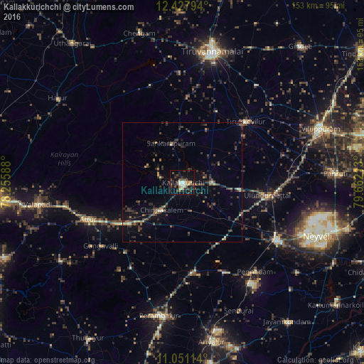
Analysis of Kallakkurichchi night lights 2016
Square area 10x10 km:
 0.21%
0.21%90-99
7.02%80-89
2.27%70-79
3.51%60-69
0.62%50-59
6.2%40-49
6.4%30-39
7.64%20-29
4.75%10-19
34.71%0-9
26.65%Square area 50x50 km:
0.01%90-99
0.59%80-89
0.37%70-79
0.56%60-69
0.5%50-59
1.1%40-49
1.65%30-39
2.21%20-29
2.34%10-19
3.67%0-9
87.01%Clear (daylight) street map image can be seen on geolist.org.
Map coordinates:
12° 25' 40.6" North, 78° 15' 21.2" East
11° 44' 25.4" North, 78° 57' 32.4" East
11° 3' 4.1" North, 79° 39' 43.7" East
Some cities around Kallakkurichchi sort by population:
• Vriddhāchalam
46.8 km =29.1 mi,  121°
121°
• Attur
42.2 km =26.2 mi,  247°
247°
• Tirukkoyilur
36.5 km =22.7 mi,  46°
46°
• Chinna Salem
15 km =9.3 mi,  218°
218°
• Gangavalli
43.1 km =26.8 mi,  231°
231°
• Vīraganūr
38.2 km =23.7 mi, 219°
• Alagāpuram
16.9 km =10.5 mi,  344°
344°
• Manalūrpettai
33.1 km =20.6 mi,  25°
25°
1268376 (p: 40,449)
Sources (retrieved 2019-11-25):
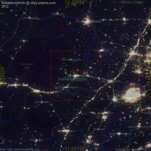
» Earth at Night: Flat Maps 2012, 2016