Kūmher night lights from space
Night Light of Kūmher (Rajasthan) from space (India) Src. Average luminocity for 10x10km area is 5.7689% and for 50x50km: 10.5817%.
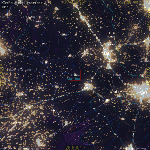
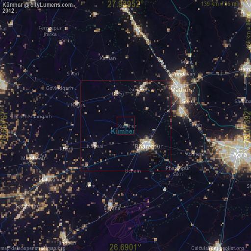
Analysis of Kūmher night lights 2016
Square area 10x10 km:
 0%
0%90-99
0.76%80-89
0%70-79
0.76%60-69
0%50-59
2.84%40-49
1.7%30-39
2.65%20-29
0.38%10-19
0.76%0-9
90.15%Square area 50x50 km:
0.55%90-99
0.94%80-89
1.78%70-79
0.6%60-69
1.12%50-59
1.85%40-49
2.03%30-39
2.55%20-29
3.87%10-19
9.1%0-9
75.61%Clear (daylight) street map image can be seen on geolist.org.
Map coordinates:
27° 56' 22.3" North, 76° 40' 3.6" East
27° 18' 59.7" North, 77° 22' 14.8" East
26° 41' 24.4" North, 78° 4' 26.1" East
Some cities around Kūmher sort by population:
• Mathura
36.3 km =22.6 mi,  55°
55°
• Bharatpur
16.2 km =10.1 mi,  133°
133°
• Dīg
17.8 km =11.1 mi,  345°
345°
• Nagar
29.4 km =18.3 mi,  294°
294°
• Nādbai
20.2 km =12.6 mi,  238°
238°
• Govardhan
22 km =13.7 mi,  24°
24°
• Barsāna
36.9 km =22.9 mi,  0°
0°
• Rādhākund
26 km =16.2 mi,  27°
27°
1265655 (p: 21,903)
Sources (retrieved 2019-11-25):
» Earth at Night: Flat Maps 2012, 2016