Bharatpur night lights from space
Night Light of Bharatpur (Rajasthan) from space (India) Src. Average luminocity for 10x10km area is 56.964% and for 50x50km: 10.1655%.
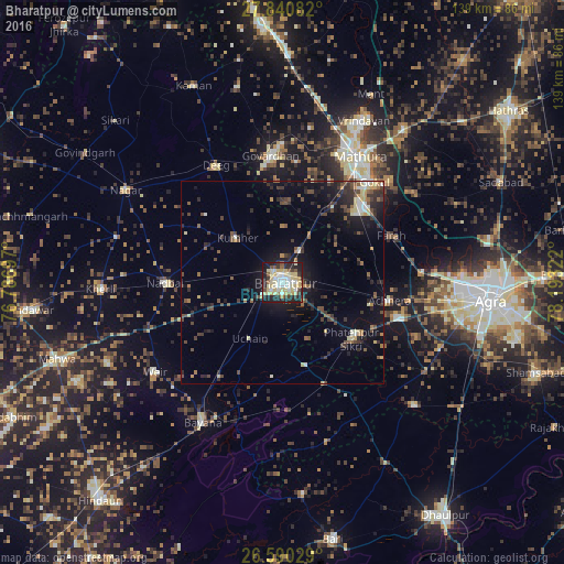
Analysis of Bharatpur night lights 2016
Square area 10x10 km:
 7.2%
7.2%90-99
13.64%80-89
22.92%70-79
2.65%60-69
2.65%50-59
5.11%40-49
4.17%30-39
6.25%20-29
18.94%10-19
16.29%0-9
0.19%Square area 50x50 km:
0.66%90-99
1.15%80-89
1.87%70-79
0.51%60-69
0.85%50-59
1.59%40-49
2.07%30-39
2.19%20-29
3.68%10-19
7.52%0-9
77.91%Clear (daylight) street map image can be seen on geolist.org.
Map coordinates:
27° 50' 27" North, 76° 47' 13.1" East
27° 13' 2.3" North, 77° 29' 24.3" East
26° 35' 25" North, 78° 11' 35.6" East
Some cities around Bharatpur sort by population:
• Dīg
32.6 km =20.3 mi,  330°
330°
• Fatehpur Sīkri
21.7 km =13.5 mi,  129°
129°
• Nādbai
29.1 km =18.1 mi,  271°
271°
• Kūmher
16.2 km =10.1 mi,  313°
313°
• Kiraoli
30.5 km =19 mi,  106°
106°
• Achhnera
26.7 km =16.6 mi,  99°
99°
• Govardhan
31.2 km =19.4 mi,  355°
355°
• Farah
29.2 km =18.1 mi,  66°
66°
1276128 (p: 229,384)
Sources (retrieved 2019-11-25):
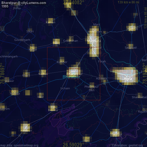
» NASA, Earths city lights 1995
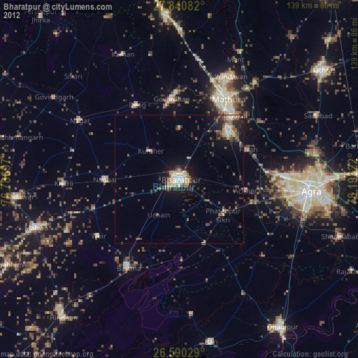
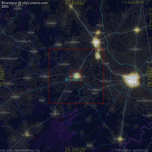
» NASA city lights 2003
» Earth at Night: Flat Maps 2012, 2016