Kondalwādi night lights from space
Night Light of Kondalwādi (Maharashtra) from space (India) Src. Average luminocity for 10x10km area is 7.2944% and for 50x50km: 5.6995%.
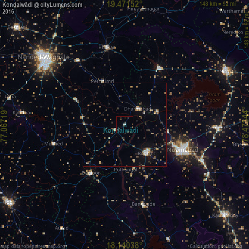
Analysis of Kondalwādi night lights 2016
Square area 10x10 km:
 0.87%
0.87%90-99
1.3%80-89
0%70-79
0%60-69
0.43%50-59
0.87%40-49
2.81%30-39
1.52%20-29
3.25%10-19
1.52%0-9
87.45%Square area 50x50 km:
0.36%90-99
0.45%80-89
0.33%70-79
0.59%60-69
0.44%50-59
1.23%40-49
1.45%30-39
1.48%20-29
1.62%10-19
2.36%0-9
89.69%Clear (daylight) street map image can be seen on geolist.org.
Map coordinates:
19° 28' 17.5" North, 77° 4' 1.9" East
18° 48' 26.2" North, 77° 46' 13.1" East
18° 8' 25.4" North, 78° 28' 24.4" East
Some cities around Kondalwādi sort by population:
• Nizāmābād
37.7 km =23.4 mi,  113°
113°
• Bodhan
20.2 km =12.6 mi,  143°
143°
• Dīglūr
35.3 km =21.9 mi,  215°
215°
• Bhaisa
39.6 km =24.6 mi,  30°
30°
• Dharmābād
12.5 km =7.8 mi,  41°
41°
• Mukher
43.8 km =27.2 mi,  255°
255°
• Mudkhed
47.9 km =29.8 mi,  324°
324°
• Biloli
6.1 km =3.8 mi,  232°
232°
1266210 (p: 14,770)
Sources (retrieved 2019-11-25):
» Earth at Night: Flat Maps 2012, 2016