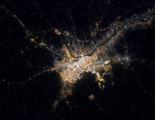
Kolkata night lights from space
Night Light of Kolkata (West Bengal) from space (India) Src. Average luminocity for 10x10km area is 99.9564% and for 50x50km: 81.8065%.

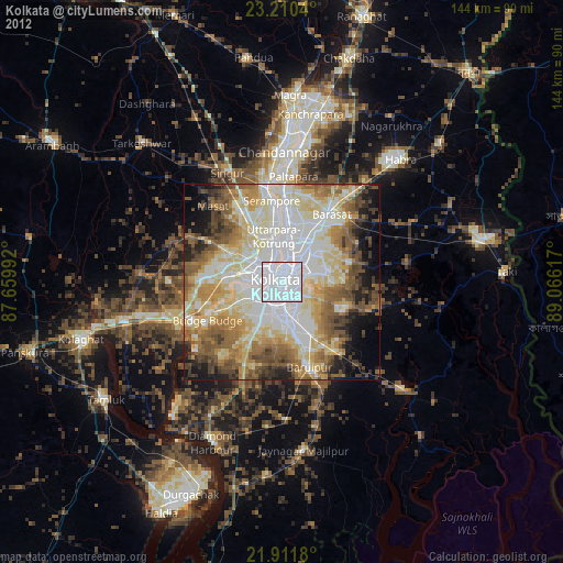
Analysis of Kolkata night lights 2016
Square area 10x10 km:
 96.02%
90-99
3.98%80-89
0%70-79
0%60-69
0%50-59
0%40-49
0%30-39
0%20-29
0%10-19
0%0-9
0%Square area 50x50 km:
23.44%90-99
28.95%80-89
14.83%70-79
8.06%60-69
7.84%50-59
6.31%40-49
4.64%30-39
3.04%20-29
2.48%10-19
0.42%0-9
0%Clear (daylight) street map image can be seen on geolist.org.
Map coordinates:
23° 12' 37.4" North, 87° 39' 35.7" East
22° 33' 45.5" North, 88° 21' 46.9" East
21° 54' 42.5" North, 89° 3' 58.2" East
Fantastic image of Kolkata from space taken by astronauts [src2], but I don't have information about it's orientation, scale or angle. If necessary, it was rotated manually, so North points approximately to upper direction. Click to zoom in:
Some cities around Kolkata sort by population:
• Hāora
4.8 km =3 mi,  289°
289°
• Bāli
9.8 km =6.1 mi,  346°
346°
• Baranagar
8.9 km =5.5 mi,  9°
9°
• Dam Dam
10 km =6.2 mi,  37°
37°
• Bankra
9.9 km =6.2 mi,  297°
297°
• Chakapara
7.9 km =4.9 mi, 349°
• Garui
8.7 km =5.4 mi,  25°
25°
• Bara Bazar
1.4 km =0.9 mi, 288°
1275004 (p: 4,631,392)
Sources (retrieved 2019-11-25):
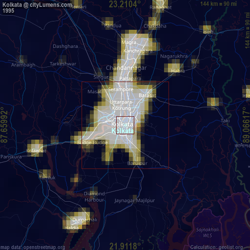
» NASA, Earths city lights 1995
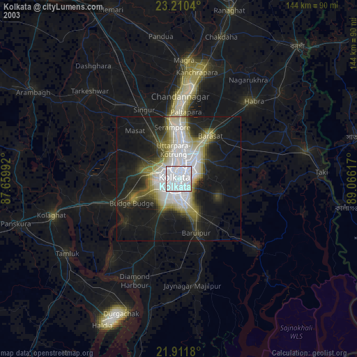
» NASA city lights 2003
» Earth at Night: Flat Maps 2012, 2016
Src.2: NASA.gov