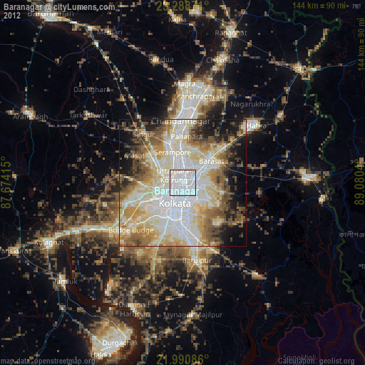
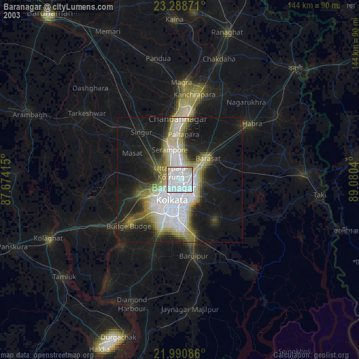
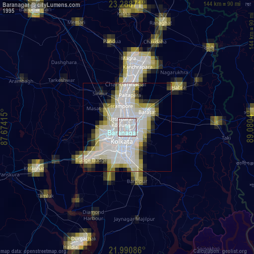
Baranagar night lights from space
Night Light of Baranagar (West Bengal) from space (India) Src. Average luminocity for 10x10km area is 99.871% and for 50x50km: 80.159%.
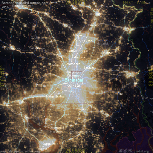
Analysis of Baranagar night lights 2016
Square area 10x10 km:
 92.46%
90-99
7.54%80-89
0%70-79
0%60-69
0%50-59
0%40-49
0%30-39
0%20-29
0%10-19
0%0-9
0%Square area 50x50 km:
24.62%90-99
27.66%80-89
11.97%70-79
6.98%60-69
7.55%50-59
7.45%40-49
6.32%30-39
3.93%20-29
2.76%10-19
0.76%0-9
0%Clear (daylight) street map image can be seen on geolist.org.
Map coordinates:
23° 17' 19.4" North, 87° 40' 26.9" East
22° 38' 28.8" North, 88° 22' 38.2" East
21° 59' 27.1" North, 89° 4' 49.4" East
Some cities around Baranagar sort by population:
• Pānihāti
5.5 km =3.4 mi,  356°
356°
• Kāmārhāti
3.3 km =2.1 mi, 355°
• Bāli
3.8 km =2.4 mi,  282°
282°
• Dam Dam
4.8 km =3 mi,  100°
100°
• Konnagar
7.8 km =4.8 mi,  334°
334°
• Chakapara
3.1 km =1.9 mi,  251°
251°
• Garui
2.5 km =1.6 mi,  110°
110°
• Sodpur
7.2 km =4.5 mi,  11°
11°
1277082 (p: 260,072)
Sources (retrieved 2019-11-25):
» NASA, Earths city lights 1995
» NASA city lights 2003
» Earth at Night: Flat Maps 2012, 2016