Bāli night lights from space
Night Light of Bāli (West Bengal) from space (India) Src. Average luminocity for 10x10km area is 98.8849% and for 50x50km: 79.9621%.
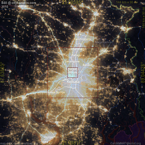
Analysis of Bāli night lights 2016
Square area 10x10 km:
 68.45%
90-99
31.55%80-89
0%70-79
0%60-69
0%50-59
0%40-49
0%30-39
0%20-29
0%10-19
0%0-9
0%Square area 50x50 km:
24.7%90-99
27.64%80-89
11.94%70-79
7.23%60-69
7.9%50-59
7.05%40-49
5.65%30-39
3.14%20-29
2.59%10-19
2.14%0-9
0.02%Clear (daylight) street map image can be seen on geolist.org.
Map coordinates:
23° 17' 45.4" North, 87° 38' 16.9" East
22° 38' 54.9" North, 88° 20' 28.1" East
21° 59' 53.4" North, 89° 2' 39.4" East
Some cities around Bāli sort by population:
• Pānihāti
5.8 km =3.6 mi,  35°
35°
• Kāmārhāti
4.3 km =2.7 mi,  53°
53°
• Baranagar
3.8 km =2.4 mi,  102°
102°
• Konnagar
6.3 km =3.9 mi,  3°
3°
• Chakapara
2 km =1.2 mi,  157°
157°
• Garui
6.3 km =3.9 mi,  105°
105°
• Krishnapur
7.7 km =4.8 mi,  288°
288°
• Sodpur
8.1 km =5 mi, 39°
1277539 (p: 296,973)
Sources (retrieved 2019-11-25):
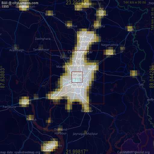
» NASA, Earths city lights 1995
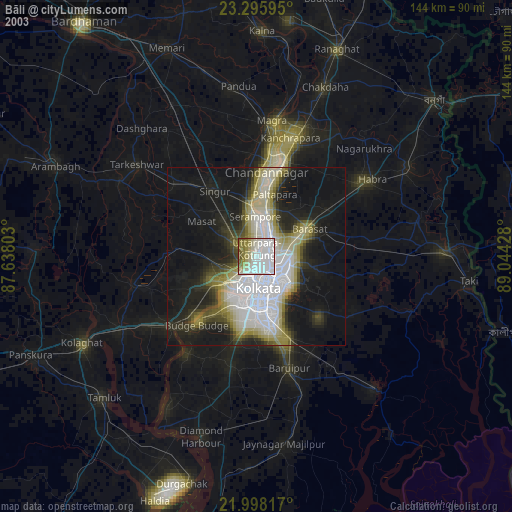
» NASA city lights 2003
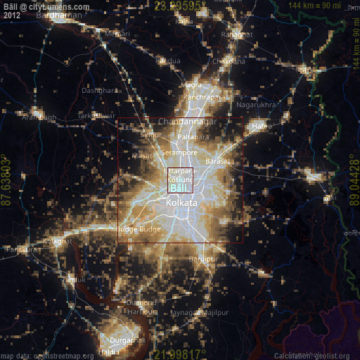
» Earth at Night: Flat Maps 2012, 2016