Kolhāpur night lights from space
Night Light of Kolhāpur (Maharashtra) from space (India) Src. Average luminocity for 10x10km area is 84.9026% and for 50x50km: 17.9416%.
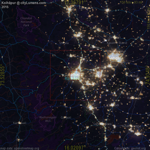
Analysis of Kolhāpur night lights 2016
Square area 10x10 km:
 28.79%
90-99
32.9%80-89
13.42%70-79
1.95%60-69
5.63%50-59
6.71%40-49
5.19%30-39
2.6%20-29
2.81%10-19
0%0-9
0%Square area 50x50 km:
1.98%90-99
3.32%80-89
2.04%70-79
0.74%60-69
2.2%50-59
2.55%40-49
3.39%30-39
3.94%20-29
7.48%10-19
11.73%0-9
60.61%Clear (daylight) street map image can be seen on geolist.org.
Map coordinates:
17° 22' 4.5" North, 73° 31' 42.8" East
16° 41' 44.3" North, 74° 13' 54" East
16° 1' 15.5" North, 74° 56' 5.3" East
Some cities around Kolhāpur sort by population:
• Ichalkaranji
24.4 km =15.2 mi,  91°
91°
• Nipāni
36.7 km =22.8 mi,  153°
153°
• Jaisingpur
35.4 km =22 mi,  75°
75°
• Ashta
34 km =21.1 mi,  33°
33°
• Kāgal
15.9 km =9.9 mi, 145°
• Sadalgi
35.4 km =22 mi,  115°
115°
• Kodoli
20.6 km =12.8 mi,  347°
347°
• Murgūd
33.6 km =20.9 mi,  187°
187°
1266285 (p: 516,142)
Sources (retrieved 2019-11-25):
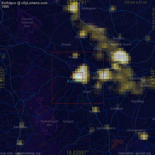
» NASA, Earths city lights 1995
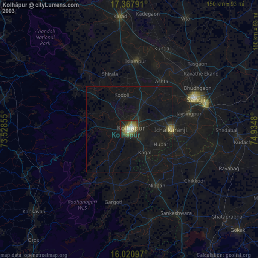
» NASA city lights 2003
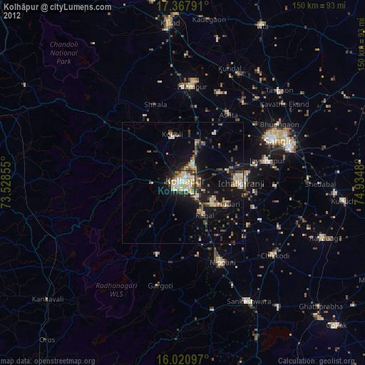
» Earth at Night: Flat Maps 2012, 2016