Nipāni night lights from space
Night Light of Nipāni (Maharashtra) from space (India) Src. Average luminocity for 10x10km area is 36.2748% and for 50x50km: 10.9362%.
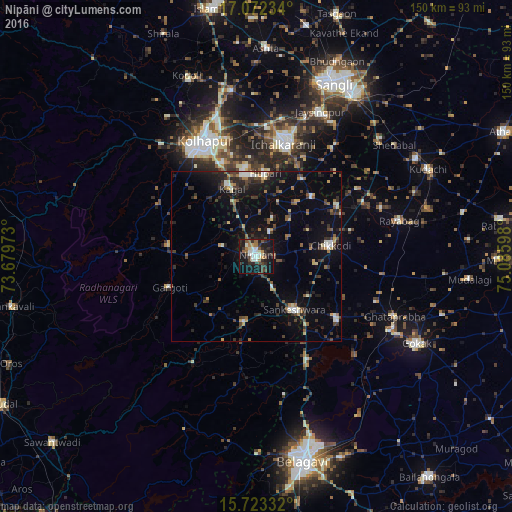
Analysis of Nipāni night lights 2016
Square area 10x10 km:
 4.75%
4.75%90-99
8.68%80-89
1.45%70-79
2.69%60-69
3.51%50-59
5.99%40-49
5.58%30-39
9.71%20-29
11.98%10-19
37.19%0-9
8.47%Square area 50x50 km:
0.75%90-99
1.43%80-89
0.85%70-79
0.83%60-69
1.26%50-59
1.55%40-49
2.08%30-39
2.47%20-29
3.25%10-19
9.15%0-9
76.39%Clear (daylight) street map image can be seen on geolist.org.
Map coordinates:
17° 4' 20.4" North, 73° 40' 47" East
16° 23' 56.4" North, 74° 22' 58.3" East
15° 43' 24" North, 75° 5' 9.5" East
Some cities around Nipāni sort by population:
• Ichalkaranji
33.5 km =20.8 mi,  14°
14°
• Chikodi
21.9 km =13.6 mi,  81°
81°
• Sankeshwar
19.1 km =11.9 mi,  146°
146°
• Gadhinglaj
19.9 km =12.4 mi,  190°
190°
• Kāgal
21.1 km =13.1 mi,  340°
340°
• Sadalgi
23.8 km =14.8 mi,  41°
41°
• Hukeri
30 km =18.6 mi,  128°
128°
• Murgūd
20.4 km =12.7 mi,  269°
269°
1261309 (p: 60,351)
Sources (retrieved 2019-11-25):
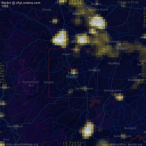
» NASA, Earths city lights 1995
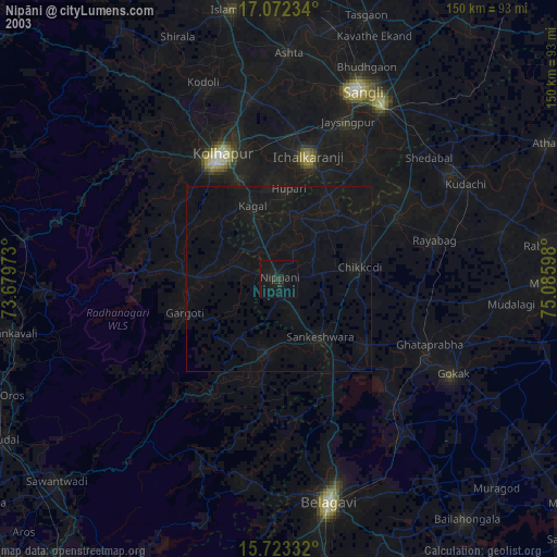
» NASA city lights 2003
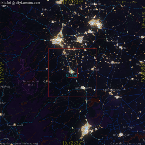
» Earth at Night: Flat Maps 2012, 2016