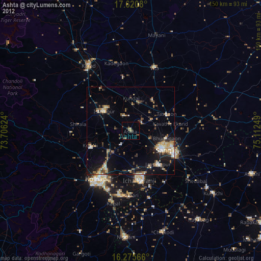
Ashta night lights from space
Night Light of Ashta (Maharashtra) from space (India) Src. Average luminocity for 10x10km area is 17.829% and for 50x50km: 20.3159%.
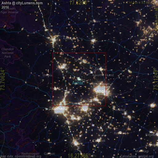
Analysis of Ashta night lights 2016
Square area 10x10 km:
 1.08%
1.08%90-99
3.25%80-89
2.16%70-79
2.16%60-69
0.65%50-59
1.08%40-49
2.6%30-39
4.11%20-29
3.9%10-19
6.06%0-9
72.94%Square area 50x50 km:
1.65%90-99
3.55%80-89
1.65%70-79
1.06%60-69
2.28%50-59
3.39%40-49
4.08%30-39
5.22%20-29
6.86%10-19
14.28%0-9
55.99%Clear (daylight) street map image can be seen on geolist.org.
Map coordinates:
17° 37' 14.9" North, 73° 42' 22.5" East
16° 56' 57.9" North, 74° 24' 33.7" East
16° 16' 32.4" North, 75° 6' 45" East
Some cities around Ashta sort by population:
• Sāngli
19.6 km =12.2 mi,  122°
122°
• Kolhāpur
34 km =21.1 mi,  213°
213°
• Ichalkaranji
29.2 km =18.1 mi,  169°
169°
• Jaisingpur
24.6 km =15.3 mi,  141°
141°
• Tāsgaon
22.7 km =14.1 mi,  64°
64°
• Kurandvād
35.2 km =21.9 mi,  147°
147°
• Kodoli
24.6 km =15.3 mi,  250°
250°
• Bhudgaon
20.8 km =12.9 mi,  103°
103°
1278296 (p: 35,497)
Sources (retrieved 2019-11-25):
» Earth at Night: Flat Maps 2012, 2016