Chāpra night lights from space
Night Light of Chāpra (Bihar) from space (India) Src. Average luminocity for 10x10km area is 50.8902% and for 50x50km: 28.8465%.
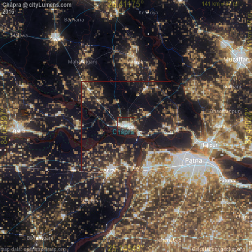
Analysis of Chāpra night lights 2016
Square area 10x10 km:
 11.93%
90-99
14.58%80-89
4.36%70-79
2.46%60-69
4.17%50-59
3.79%40-49
6.06%30-39
9.28%20-29
25.19%10-19
17.8%0-9
0.38%Square area 50x50 km:
2.8%90-99
3.93%80-89
2.68%70-79
2.82%60-69
4.26%50-59
4.81%40-49
5.53%30-39
7.48%20-29
11.81%10-19
23.25%0-9
30.63%Clear (daylight) street map image can be seen on geolist.org.
Map coordinates:
26° 24' 42.3" North, 84° 2' 38.3" East
25° 46' 49.1" North, 84° 44' 49.5" East
25° 8' 43.8" North, 85° 27' 0.8" East
Some cities around Chāpra sort by population:
• Arrah
26.3 km =16.3 mi,  198°
198°
• Dinapore
34.1 km =21.2 mi,  117°
117°
• Khagaul
37.4 km =23.2 mi,  126°
126°
• Revelganj
11.2 km =7 mi,  275°
275°
• Dighwāra
26.6 km =16.5 mi,  98°
98°
• Maner
19.5 km =12.1 mi,  139°
139°
• Marhaura
24.6 km =15.3 mi,  29°
29°
• Koelwār
22.8 km =14.2 mi,  167°
167°
1274353 (p: 201,597)
Sources (retrieved 2019-11-25):
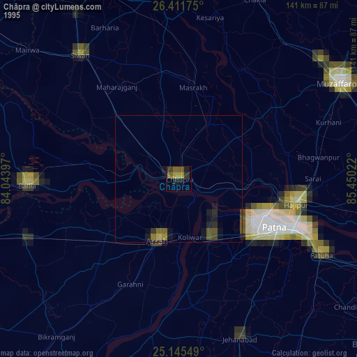
» NASA, Earths city lights 1995
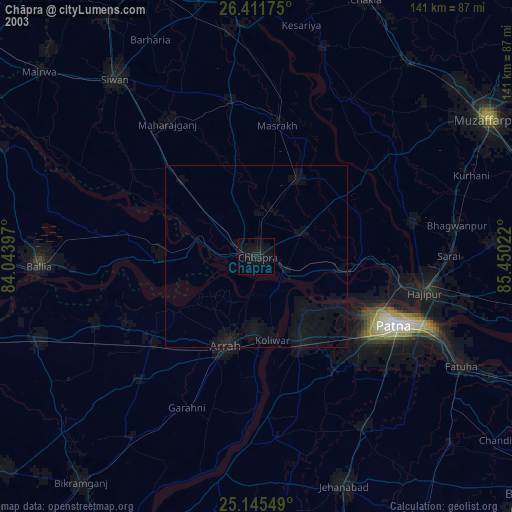
» NASA city lights 2003
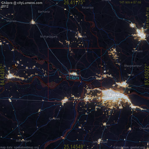
» Earth at Night: Flat Maps 2012, 2016