Revelganj night lights from space
Night Light of Revelganj (Bihar) from space (India) Src. Average luminocity for 10x10km area is 14.5417% and for 50x50km: 24.3976%.

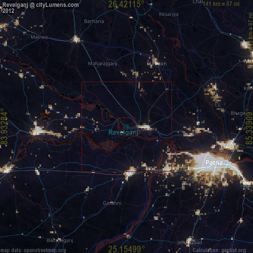
Analysis of Revelganj night lights 2016
Square area 10x10 km:
 0%
0%90-99
0.76%80-89
0.38%70-79
0.19%60-69
2.08%50-59
1.89%40-49
5.3%30-39
6.63%20-29
4.36%10-19
17.8%0-9
60.61%Square area 50x50 km:
1.8%90-99
2.8%80-89
1.99%70-79
2.24%60-69
3.14%50-59
4.25%40-49
5.11%30-39
7.32%20-29
11.01%10-19
22.43%0-9
37.91%Clear (daylight) street map image can be seen on geolist.org.
Map coordinates:
26° 25' 16.1" North, 83° 55' 58.2" East
25° 47' 23.1" North, 84° 38' 9.5" East
25° 9' 18" North, 85° 20' 20.7" East
Some cities around Revelganj sort by population:
• Arrah
26.1 km =16.2 mi,  173°
173°
• Chāpra
11.2 km =7 mi,  95°
95°
• Dighwāra
37.8 km =23.5 mi, 97°
• Maner
28.6 km =17.8 mi,  123°
123°
• Marhaura
30.9 km =19.2 mi,  48°
48°
• Koelwār
28.3 km =17.6 mi,  145°
145°
• Reoti
26.7 km =16.6 mi,  284°
284°
• Shāhpur
31.2 km =19.4 mi,  228°
228°
1258186 (p: 37,031)
Sources (retrieved 2019-11-25):
» Earth at Night: Flat Maps 2012, 2016