Khamharia night lights from space
Night Light of Khamharia (Chhattisgarh) from space (India) Src. Average luminocity for 10x10km area is 6.7024% and for 50x50km: 12.8066%.
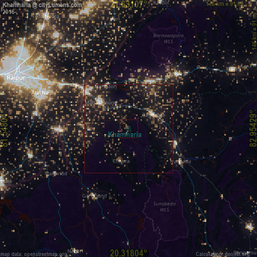
Analysis of Khamharia night lights 2016
Square area 10x10 km:
 0%
0%90-99
0%80-89
0%70-79
0%60-69
0%50-59
0.79%40-49
3.57%30-39
5.75%20-29
4.17%10-19
2.98%0-9
82.74%Square area 50x50 km:
0.56%90-99
0.88%80-89
0.53%70-79
0.77%60-69
1.54%50-59
3.19%40-49
3.39%30-39
3.89%20-29
5.05%10-19
14.46%0-9
65.73%Clear (daylight) street map image can be seen on geolist.org.
Map coordinates:
21° 37' 51.9" North, 81° 32' 52.9" East
20° 58' 33.6" North, 82° 15' 4.2" East
20° 19' 4.9" North, 82° 57' 15.4" East
Some cities around Khamharia sort by population:
• Mahāsamund
21.8 km =13.5 mi,  312°
312°
• Arang
38.2 km =23.7 mi, 309°
• Deori
64.9 km =40.3 mi,  35°
35°
• Kurud
57.3 km =35.6 mi,  253°
253°
• Gariāband
42.9 km =26.7 mi,  207°
207°
• Basna
68.5 km =42.6 mi,  60°
60°
• Bhatgaon
60.4 km =37.5 mi,  288°
288°
• Pithora
41.1 km =25.5 mi, 42°
1267083 (p: 6,998)
Sources (retrieved 2019-11-25):
» Earth at Night: Flat Maps 2012, 2016