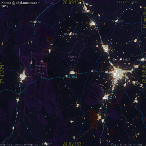
Karera night lights from space
Night Light of Karera (Madhya Pradesh) from space (India) Src. Average luminocity for 10x10km area is 20.9762% and for 50x50km: 3.8464%.
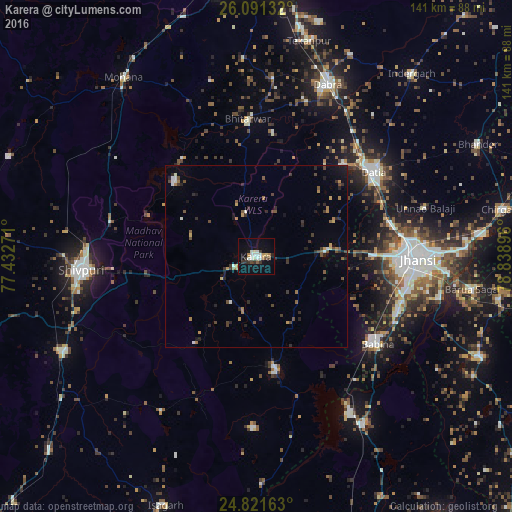
Analysis of Karera night lights 2016
Square area 10x10 km:
 4.17%
4.17%90-99
4.96%80-89
1.19%70-79
0.79%60-69
2.38%50-59
0.79%40-49
2.38%30-39
4.37%20-29
1.98%10-19
14.88%0-9
62.1%Square area 50x50 km:
0.31%90-99
0.47%80-89
0.21%70-79
0.36%60-69
0.6%50-59
0.51%40-49
0.78%30-39
0.77%20-29
1.19%10-19
1.4%0-9
93.39%Clear (daylight) street map image can be seen on geolist.org.
Map coordinates:
26° 5' 28.8" North, 77° 25' 57.8" East
25° 27' 29.3" North, 78° 8' 9" East
24° 49' 17.9" North, 78° 50' 20.3" East
Some cities around Karera sort by population:
• Jhānsi
44.6 km =27.7 mi,  89°
89°
• Shivpuri
47.7 km =29.6 mi,  265°
265°
• Datia
40.3 km =25 mi,  53°
53°
• Dabra
51.5 km =32 mi,  22°
22°
• Babīna
41.5 km =25.8 mi,  125°
125°
• Bhitarwār
37.2 km =23.1 mi,  356°
356°
• Narwar
30.4 km =18.9 mi,  312°
312°
• Khailār
41.8 km =26 mi,  108°
108°
1267786 (p: 26,212)
Sources (retrieved 2019-11-25):
» Earth at Night: Flat Maps 2012, 2016