Datia night lights from space
Night Light of Datia (Madhya Pradesh) from space (India) Src. Average luminocity for 10x10km area is 55.0057% and for 50x50km: 16.922%.
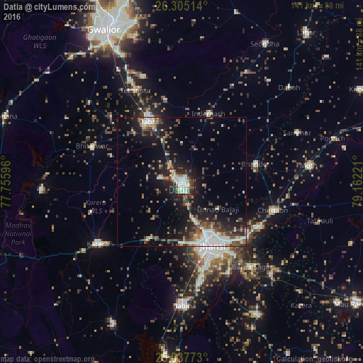
Analysis of Datia night lights 2016
Square area 10x10 km:
 10.42%
90-99
15.91%80-89
6.82%70-79
2.84%60-69
5.3%50-59
7.2%40-49
7.39%30-39
11.17%20-29
21.02%10-19
11.74%0-9
0.19%Square area 50x50 km:
2.18%90-99
3.16%80-89
1.14%70-79
1.34%60-69
1.72%50-59
2.93%40-49
3.73%30-39
3.33%20-29
5.12%10-19
11.2%0-9
64.14%Clear (daylight) street map image can be seen on geolist.org.
Map coordinates:
26° 18' 18.5" North, 77° 45' 21.5" East
25° 40' 23.2" North, 78° 27' 32.7" East
25° 2' 15.8" North, 79° 9' 44" East
Some cities around Datia sort by population:
• Jhānsi
26.7 km =16.6 mi,  153°
153°
• Dabra
26.8 km =16.7 mi,  331°
331°
• Bhānder
29.5 km =18.3 mi,  76°
76°
• Bhitarwār
37.3 km =23.2 mi,  290°
290°
• Chirgaon
37.3 km =23.2 mi,  107°
107°
• Khailār
37.6 km =23.4 mi,  168°
168°
• Barāgaon
33.6 km =20.9 mi,  130°
130°
• Pārīchha
35.3 km =21.9 mi,  121°
121°
1273403 (p: 90,628)
Sources (retrieved 2019-11-25):
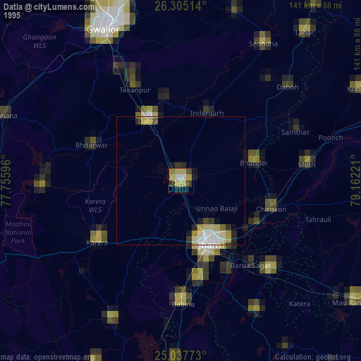
» NASA, Earths city lights 1995
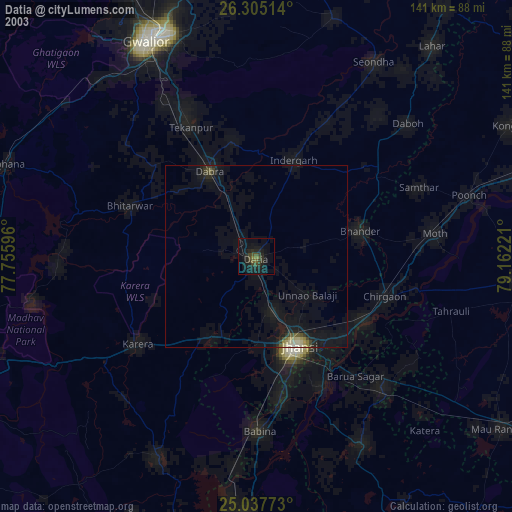
» NASA city lights 2003
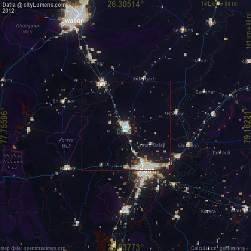
» Earth at Night: Flat Maps 2012, 2016