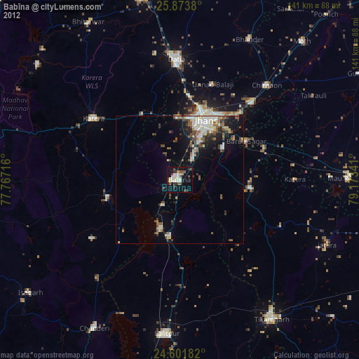
Babīna night lights from space
Night Light of Babīna (Uttar Pradesh) from space (India) Src. Average luminocity for 10x10km area is 37.0397% and for 50x50km: 16.3466%.
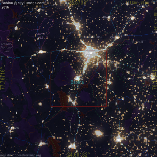
Analysis of Babīna night lights 2016
Square area 10x10 km:
 6.55%
6.55%90-99
8.53%80-89
2.38%70-79
2.78%60-69
4.37%50-59
4.37%40-49
3.17%30-39
6.15%20-29
13.1%10-19
41.07%0-9
7.54%Square area 50x50 km:
2.25%90-99
3.54%80-89
0.97%70-79
1.18%60-69
2.17%50-59
2.83%40-49
2.9%30-39
3.1%20-29
5.29%10-19
8.88%0-9
66.88%Clear (daylight) street map image can be seen on geolist.org.
Map coordinates:
25° 52' 25.7" North, 77° 46' 1.8" East
25° 14' 22.1" North, 78° 28' 13" East
24° 36' 6.6" North, 79° 10' 24.3" East
Some cities around Babīna sort by population:
• Jhānsi
26.8 km =16.7 mi,  24°
24°
• Datia
48.2 km =30 mi,  358°
358°
• Karera
41.5 km =25.8 mi,  305°
305°
• Tālbahat
22.1 km =13.7 mi,  189°
189°
• Khailār
12.9 km =8 mi,  28°
28°
• Barāgaon
35.8 km =22.2 mi,  42°
42°
• Orchha
21.2 km =13.2 mi,  53°
53°
• Pārīchha
41.7 km =25.9 mi, 44°
1278058 (p: 35,538)
Sources (retrieved 2019-11-25):
» Earth at Night: Flat Maps 2012, 2016