Dabra night lights from space
Night Light of Dabra (Madhya Pradesh) from space (India) Src. Average luminocity for 10x10km area is 49.822% and for 50x50km: 13.0914%.
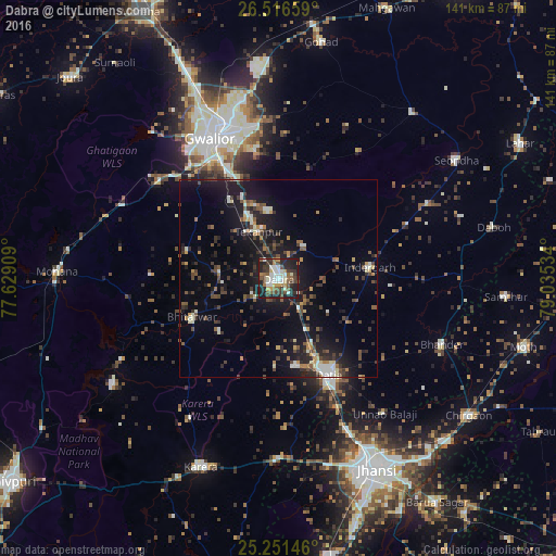
Analysis of Dabra night lights 2016
Square area 10x10 km:
 8.14%
8.14%90-99
12.12%80-89
3.6%70-79
4.92%60-69
4.55%50-59
8.52%40-49
8.71%30-39
11.93%20-29
20.08%10-19
17.42%0-9
0%Square area 50x50 km:
0.99%90-99
1.99%80-89
0.83%70-79
1.15%60-69
1.32%50-59
1.97%40-49
2.96%30-39
2.95%20-29
4.18%10-19
12.48%0-9
69.19%Clear (daylight) street map image can be seen on geolist.org.
Map coordinates:
26° 30' 59.7" North, 77° 37' 44.7" East
25° 53' 8.6" North, 78° 19' 56" East
25° 15' 5.3" North, 79° 2' 7.2" East
Some cities around Dabra sort by population:
• Gwalior
41.4 km =25.7 mi,  337°
337°
• Datia
26.8 km =16.7 mi,  151°
151°
• Morār
39.4 km =24.5 mi, 344°
• Bhānder
44.6 km =27.7 mi,  111°
111°
• Bhitarwār
24.5 km =15.2 mi,  244°
244°
• Tekanpur
13 km =8.1 mi, 337°
• Alampur
49 km =30.4 mi,  71°
71°
• Antri
22.7 km =14.1 mi,  327°
327°
1273751 (p: 60,836)
Sources (retrieved 2019-11-25):
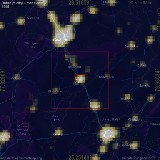
» NASA, Earths city lights 1995
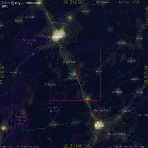
» NASA city lights 2003
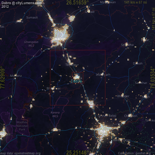
» Earth at Night: Flat Maps 2012, 2016