Mahudha night lights from space
Night Light of Mahudha (Gujarat) from space (India) Src. Average luminocity for 10x10km area is 5.2421% and for 50x50km: 20.897%.
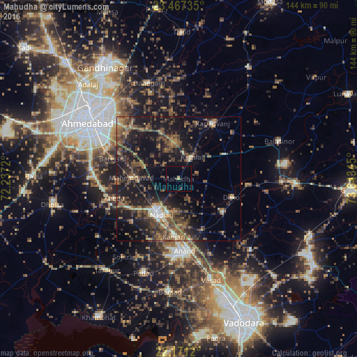
Analysis of Mahudha night lights 2016
Square area 10x10 km:
 0%
0%90-99
0%80-89
0.6%70-79
0.99%60-69
0%50-59
0%40-49
1.79%30-39
1.79%20-29
0.79%10-19
0.79%0-9
93.25%Square area 50x50 km:
0.36%90-99
1.8%80-89
1.62%70-79
1.92%60-69
3.7%50-59
5.89%40-49
6.24%30-39
5.47%20-29
7.74%10-19
18.3%0-9
46.97%Clear (daylight) street map image can be seen on geolist.org.
Map coordinates:
23° 28' 2.5" North, 72° 14' 13.9" East
22° 49' 15" North, 72° 56' 25.2" East
22° 10' 16.3" North, 73° 38' 36.4" East
Some cities around Mahudha sort by population:
• Nadiād
16.3 km =10.1 mi,  209°
209°
• Kapadvanj
26.2 km =16.3 mi,  30°
30°
• Chaklāsi
18.6 km =11.6 mi,  178°
178°
• Umreth
22.5 km =14 mi,  127°
127°
• Mahemdāvād
18.9 km =11.7 mi,  270°
270°
• Dākor
22.8 km =14.2 mi,  109°
109°
• Kheda
27.2 km =16.9 mi,  253°
253°
• Vasa
26 km =16.2 mi,  226°
226°
1264344 (p: 16,828)
Sources (retrieved 2019-11-25):
» Earth at Night: Flat Maps 2012, 2016