Kāmāreddi night lights from space
Night Light of Kāmāreddi (Telangana) from space (India) Src. Average luminocity for 10x10km area is 33.8017% and for 50x50km: 7.3806%.
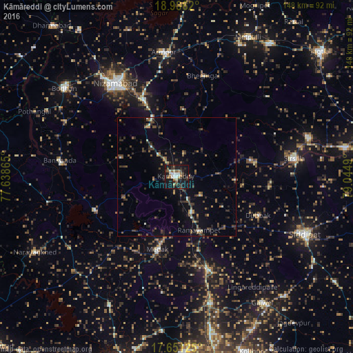
Analysis of Kāmāreddi night lights 2016
Square area 10x10 km:
 4.55%
4.55%90-99
5.58%80-89
3.31%70-79
2.27%60-69
4.55%50-59
4.34%40-49
6.2%30-39
5.37%20-29
10.54%10-19
44.42%0-9
8.88%Square area 50x50 km:
0.28%90-99
0.67%80-89
0.39%70-79
0.54%60-69
0.98%50-59
1.54%40-49
1.89%30-39
1.97%20-29
2.15%10-19
4.63%0-9
84.95%Clear (daylight) street map image can be seen on geolist.org.
Map coordinates:
18° 59' 10.3" North, 77° 38' 19.1" East
18° 19' 12" North, 78° 20' 30.4" East
17° 39' 4.5" North, 79° 2' 41.6" East
Some cities around Kāmāreddi sort by population:
• Nizāmābād
46.7 km =29 mi,  326°
326°
• Sirsilla
50 km =31.1 mi,  81°
81°
• Siddipet
58.6 km =36.4 mi,  114°
114°
• Medak
31.7 km =19.7 mi,  195°
195°
• Vemalwāda
57.9 km =36 mi,  73°
73°
• Bānswāda
49.1 km =30.5 mi,  277°
277°
• Chandūr
55.7 km =34.6 mi,  207°
207°
• Nārsingi
31.9 km =19.8 mi,  163°
163°
1268259 (p: 71,042)
Sources (retrieved 2019-11-25):
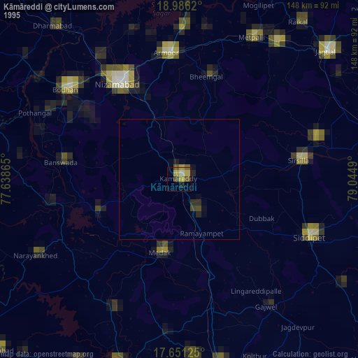
» NASA, Earths city lights 1995
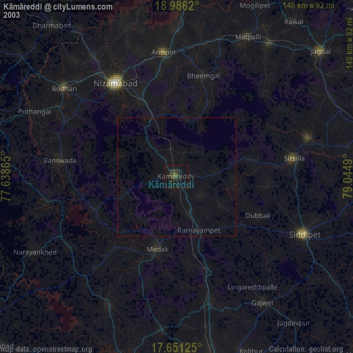
» NASA city lights 2003
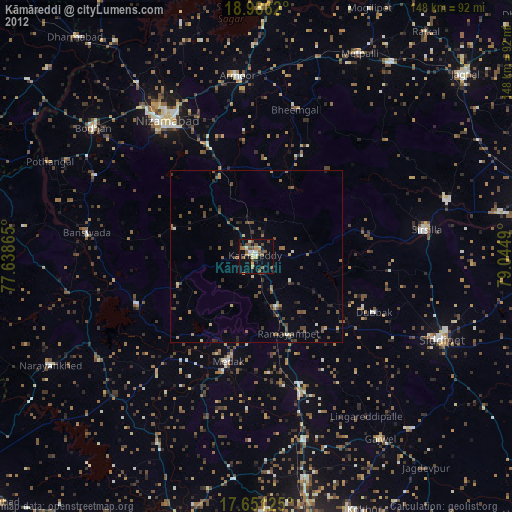
» Earth at Night: Flat Maps 2012, 2016