Charthāwal night lights from space
Night Light of Charthāwal (Uttar Pradesh) from space (India) Src. Average luminocity for 10x10km area is 29.9375% and for 50x50km: 34.8724%.
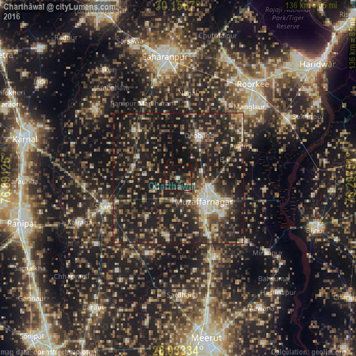
Analysis of Charthāwal night lights 2016
Square area 10x10 km:
 1.52%
1.52%90-99
1.89%80-89
1.7%70-79
2.65%60-69
3.41%50-59
7.95%40-49
10.42%30-39
4.17%20-29
17.05%10-19
45.83%0-9
3.41%Square area 50x50 km:
2.06%90-99
4.22%80-89
3.76%70-79
3.41%60-69
4.49%50-59
6.3%40-49
9.83%30-39
7.62%20-29
16.58%10-19
37.37%0-9
4.36%Clear (daylight) street map image can be seen on geolist.org.
Map coordinates:
30° 9' 24.1" North, 76° 53' 28.5" East
29° 32' 48.7" North, 77° 35' 39.8" East
28° 56' 0" North, 78° 17' 51" East
Some cities around Charthāwal sort by population:
• Muzaffarnagar
13.5 km =8.4 mi,  128°
128°
• Deoband
18.4 km =11.4 mi,  26°
26°
• Thāna Bhawan
17.6 km =10.9 mi,  284°
284°
• Jalālābad
17 km =10.6 mi,  297°
297°
• Banat
25 km =15.5 mi,  248°
248°
• Shāhpur
22.3 km =13.9 mi,  190°
190°
• Nanauta
25.1 km =15.6 mi,  317°
317°
• Sisauli
19.1 km =11.9 mi,  219°
219°
1274560 (p: 19,942)
Sources (retrieved 2019-11-25):
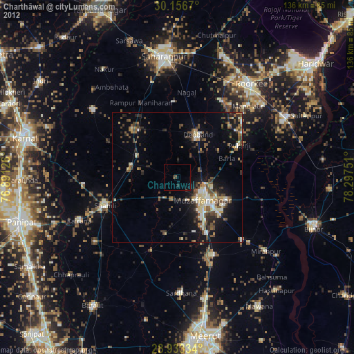
» Earth at Night: Flat Maps 2012, 2016