Banat night lights from space
Night Light of Banat (Uttar Pradesh) from space (India) Src. Average luminocity for 10x10km area is 39.8144% and for 50x50km: 28.8763%.
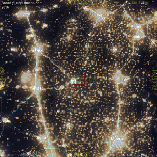
Analysis of Banat night lights 2016
Square area 10x10 km:
 2.46%
2.46%90-99
5.11%80-89
3.79%70-79
5.87%60-69
3.6%50-59
7.2%40-49
11.36%30-39
12.12%20-29
20.64%10-19
27.84%0-9
0%Square area 50x50 km:
0.97%90-99
2.37%80-89
2.14%70-79
2.56%60-69
3.54%50-59
5.71%40-49
8.91%30-39
7.88%20-29
14.72%10-19
38.43%0-9
12.76%Clear (daylight) street map image can be seen on geolist.org.
Map coordinates:
30° 4' 26" North, 76° 39' 6" East
29° 27' 48.8" North, 77° 21' 17.2" East
28° 50' 58.3" North, 78° 3' 28.5" East
Some cities around Banat sort by population:
• Shāmli
4.6 km =2.9 mi,  250°
250°
• Kairāna
16.3 km =10.1 mi,  242°
242°
• Kāndhla
17.8 km =11.1 mi,  207°
207°
• Thāna Bhawan
14.9 km =9.3 mi,  24°
24°
• Jhinjhāna
14.1 km =8.8 mi,  296°
296°
• Sisauli
12.4 km =7.7 mi,  116°
116°
• Ūn
16.6 km =10.3 mi,  324°
324°
• Garhi Pūkhta
10.6 km =6.6 mi,  335°
335°
1277409 (p: 21,580)
Sources (retrieved 2019-11-25):
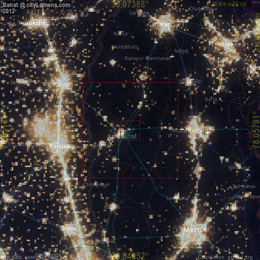
» Earth at Night: Flat Maps 2012, 2016