Kottūru night lights from space
Night Light of Kottūru (Karnataka) from space (India) Src. Average luminocity for 10x10km area is 11.7748% and for 50x50km: 4.0187%.
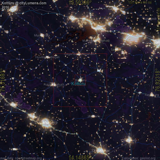
Analysis of Kottūru night lights 2016
Square area 10x10 km:
 1.03%
1.03%90-99
2.27%80-89
1.45%70-79
1.03%60-69
1.65%50-59
2.27%40-49
2.69%30-39
0.83%20-29
0.21%10-19
0.62%0-9
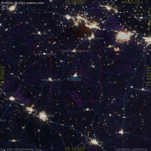
85.95%Square area 50x50 km:
0.15%90-99
0.53%80-89
0.24%70-79
0.28%60-69
0.64%50-59
0.96%40-49
1.18%30-39
0.74%20-29
0.89%10-19
0.65%0-9
93.74%Clear (daylight) street map image can be seen on geolist.org.
Map coordinates:
15° 30' 11" North, 75° 31' 0.9" East
14° 49' 27.9" North, 76° 13' 12.2" East
14° 8' 37.1" North, 76° 55' 23.4" East
Some cities around Kottūru sort by population:
• Davangere
50.7 km =31.5 mi,  218°
218°
• Hospet
52.6 km =32.7 mi,  19°
19°
• Harpanahalli
25.2 km =15.7 mi,  260°
260°
• Sandūr
45.6 km =28.3 mi,  50°
50°
• Hadagalli
37.9 km =23.5 mi,  305°
305°
• Kūdligi
19.9 km =12.4 mi,  63°
63°
• Jagalūr
36.2 km =22.5 mi,  159°
159°
• Munirābād
55.4 km =34.4 mi,  13°
13°
1265905 (p: 24,004)
Sources (retrieved 2019-11-25):
» Earth at Night: Flat Maps 2012, 2016