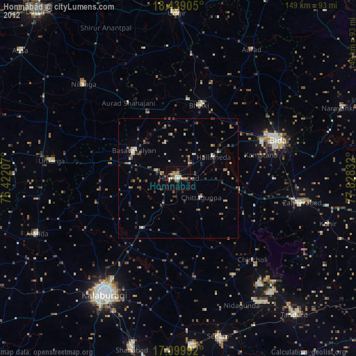
Homnābād night lights from space
Night Light of Homnābād (Karnataka) from space (India) Src. Average luminocity for 10x10km area is 31.1688% and for 50x50km: 7.2477%.
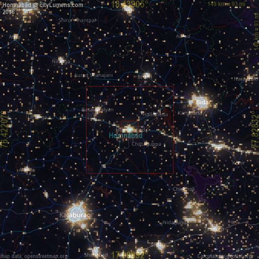
Analysis of Homnābād night lights 2016
Square area 10x10 km:
 3.03%
3.03%90-99
6.71%80-89
4.33%70-79
2.38%60-69
3.68%50-59
2.81%40-49
6.71%30-39
1.95%20-29
4.76%10-19
51.08%0-9
12.55%Square area 50x50 km:
0.29%90-99
0.55%80-89
0.48%70-79
0.78%60-69
0.69%50-59
1.69%40-49
1.68%30-39
1.92%20-29
2.1%10-19
4.3%0-9
85.53%Clear (daylight) street map image can be seen on geolist.org.
Map coordinates:
18° 26' 20.6" North, 76° 25' 19.5" East
17° 46' 14.7" North, 77° 7' 30.7" East
17° 5' 59.7" North, 77° 49' 42" East
Some cities around Homnābād sort by population:
• Gulbarga
57.2 km =35.5 mi,  212°
212°
• Bīdar
45.7 km =28.4 mi,  69°
69°
• Basavakalyān
21.9 km =13.6 mi,  301°
301°
• Zahirābād
52 km =32.3 mi,  101°
101°
• Bhālki
31.5 km =19.6 mi,  15°
15°
• Nilanga
55.1 km =34.2 mi,  314°
314°
• Umarga
53.7 km =33.4 mi,  278°
278°
• Chincholi
46.1 km =28.6 mi,  137°
137°
1269979 (p: 41,485)
Sources (retrieved 2019-11-25):
» Earth at Night: Flat Maps 2012, 2016