Guntakal Junction night lights from space
Night Light of Guntakal Junction (Andhra Pradesh) from space (India) Src. Average luminocity for 10x10km area is 26.6963% and for 50x50km: 3.5635%.
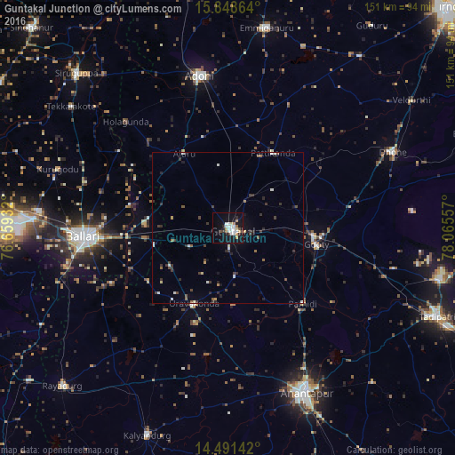
Analysis of Guntakal Junction night lights 2016
Square area 10x10 km:
 4.75%
4.75%90-99
7.64%80-89
1.65%70-79
4.55%60-69
0.83%50-59
1.24%40-49
2.07%30-39
1.45%20-29
3.51%10-19
29.96%0-9
42.36%Square area 50x50 km:
0.24%90-99
0.79%80-89
0.22%70-79
0.31%60-69
0.18%50-59
0.45%40-49
0.52%30-39
1.04%20-29
0.79%10-19
1.98%0-9
93.49%Clear (daylight) street map image can be seen on geolist.org.
Map coordinates:
15° 50' 55.1" North, 76° 39' 33.6" East
15° 10' 16" North, 77° 21' 44.8" East
14° 29' 29.1" North, 78° 3' 56.1" East
Some cities around Guntakal Junction sort by population:
• Bellary
47.2 km =29.3 mi,  266°
266°
• Anantapur
60.9 km =37.8 mi,  154°
154°
• Ādoni
51.6 km =32.1 mi,  349°
349°
• Emmiganūr
68.1 km =42.3 mi,  10°
10°
• Dhone
60 km =37.3 mi,  65°
65°
• Uravakonda
27.8 km =17.3 mi,  204°
204°
• Tekkalakote
65.9 km =40.9 mi,  307°
307°
• Rāmāpuram
55.7 km =34.6 mi,  76°
76°
1270670 (p: 120,964)
Sources (retrieved 2019-11-25):
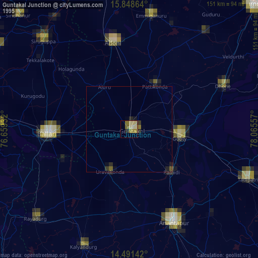
» NASA, Earths city lights 1995
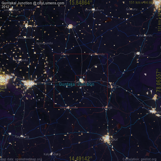
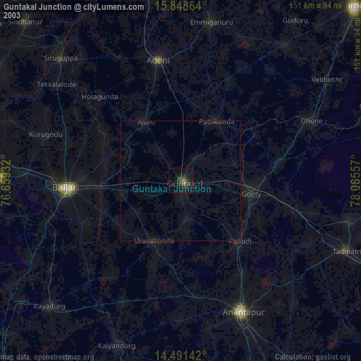
» NASA city lights 2003
» Earth at Night: Flat Maps 2012, 2016