Ādoni night lights from space
Night Light of Ādoni (Andhra Pradesh) from space (India) Src. Average luminocity for 10x10km area is 29.0303% and for 50x50km: 3.499%.
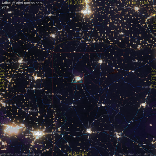
Analysis of Ādoni night lights 2016
Square area 10x10 km:
 3.03%
3.03%90-99
9.31%80-89
1.73%70-79
1.73%60-69
2.81%50-59
3.46%40-49
4.76%30-39
4.98%20-29
1.52%10-19
32.47%0-9
34.2%Square area 50x50 km:
0.21%90-99
0.65%80-89
0.16%70-79
0.09%60-69
0.42%50-59
0.63%40-49
1.06%30-39
0.81%20-29
0.81%10-19
1.89%0-9
93.27%Clear (daylight) street map image can be seen on geolist.org.
Map coordinates:
16° 18' 14" North, 76° 34' 18.6" East
15° 37' 40.4" North, 77° 16' 29.8" East
14° 56' 58.7" North, 77° 58' 41.1" East
Some cities around Ādoni sort by population:
• Rāichūr
64.8 km =40.3 mi,  7°
7°
• Guntakal Junction
51.6 km =32.1 mi,  169°
169°
• Emmiganūr
27.5 km =17.1 mi,  54°
54°
• Sindhnūr
57.8 km =35.9 mi,  285°
285°
• Siruguppa
41 km =25.5 mi,  270°
270°
• Mānvi
47 km =29.2 mi,  329°
329°
• Tekkalakote
43.9 km =27.3 mi,  256°
256°
• Kosigi
25.5 km =15.8 mi,  352°
352°
1279335 (p: 163,631)
Sources (retrieved 2019-11-25):
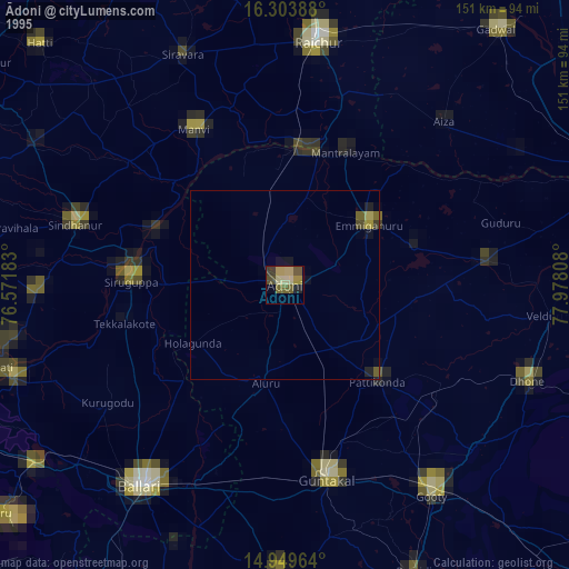
» NASA, Earths city lights 1995
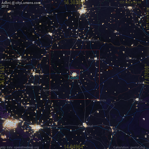
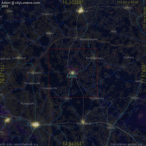
» NASA city lights 2003
» Earth at Night: Flat Maps 2012, 2016