Bellary night lights from space
Night Light of Bellary (Karnataka) from space (India) Src. Average luminocity for 10x10km area is 76.1818% and for 50x50km: 15.888%.

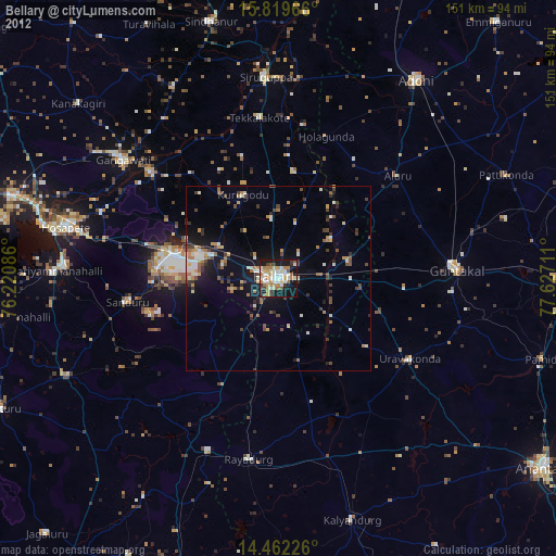
Analysis of Bellary night lights 2016
Square area 10x10 km:
 23.76%
90-99
29.75%80-89
5.37%70-79
4.75%60-69
6.2%50-59
5.37%40-49
8.68%30-39
7.02%20-29
8.47%10-19
0.62%0-9
0%Square area 50x50 km:
1.6%90-99
3.22%80-89
1.22%70-79
1.23%60-69
2.23%50-59
2.54%40-49
2.63%30-39
3.22%20-29
5.02%10-19
9.04%0-9
68.05%Clear (daylight) street map image can be seen on geolist.org.
Map coordinates:
15° 49' 10.8" North, 76° 13' 15.1" East
15° 8' 31.4" North, 76° 55' 26.3" East
14° 27' 44.1" North, 77° 37' 37.6" East
Some cities around Bellary sort by population:
• Guntakal Junction
47.2 km =29.3 mi,  86°
86°
• Gangāwati
53.2 km =33.1 mi,  307°
307°
• Rāyadrug
49.8 km =30.9 mi,  188°
188°
• Kampli
45.5 km =28.3 mi, 310°
• Uravakonda
41.8 km =26 mi,  121°
121°
• Sandūr
40.9 km =25.4 mi,  261°
261°
• Tekkalakote
43.9 km =27.3 mi,  353°
353°
• Hampi
54.2 km =33.7 mi,  293°
293°
1276509 (p: 336,681)
Sources (retrieved 2019-11-25):
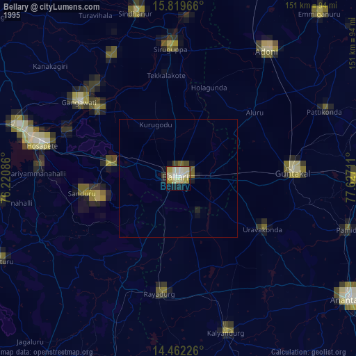
» NASA, Earths city lights 1995
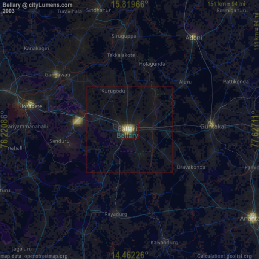
» NASA city lights 2003
» Earth at Night: Flat Maps 2012, 2016