Gangāpur night lights from space
Night Light of Gangāpur (Maharashtra) from space (India) Src. Average luminocity for 10x10km area is 14.688% and for 50x50km: 10.8581%.
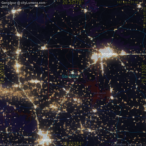
Analysis of Gangāpur night lights 2016
Square area 10x10 km:
 0.41%
0.41%90-99
2.48%80-89
4.13%70-79
0%60-69
2.48%50-59
1.86%40-49
1.24%30-39
1.03%20-29
1.03%10-19
2.48%0-9
82.85%Square area 50x50 km:
0.5%90-99
1.62%80-89
0.79%70-79
1.04%60-69
1.46%50-59
1.92%40-49
1.89%30-39
2.48%20-29
3.82%10-19
8.22%0-9
76.25%Clear (daylight) street map image can be seen on geolist.org.
Map coordinates:
20° 21' 28" North, 74° 18' 26.4" East
19° 41' 49.8" North, 75° 0' 37.6" East
19° 2' 1.8" North, 75° 42' 48.9" East
Some cities around Gangāpur sort by population:
• Aurangabad
40.1 km =24.9 mi,  59°
59°
• Vaijāpur
39.1 km =24.3 mi,  310°
310°
• Paithan
46.4 km =28.8 mi,  122°
122°
• Rāhuri
50.9 km =31.6 mi,  227°
227°
• Shirdi
56.3 km =35 mi,  277°
277°
• Pīpri
56 km =34.8 mi,  78°
78°
• Khuldābād
39.3 km =24.4 mi,  28°
28°
• Daulatābād
34.5 km =21.4 mi,  39°
39°
1271680 (p: 24,118)
Sources (retrieved 2019-11-25):
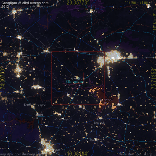
» Earth at Night: Flat Maps 2012, 2016