Aurangabad night lights from space
Night Light of Aurangabad (Maharashtra) from space (India) Src. Average luminocity for 10x10km area is 95.8117% and for 50x50km: 20.2591%.
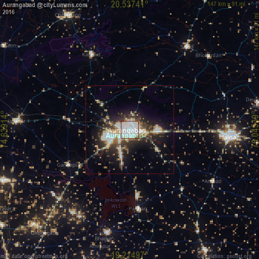
Analysis of Aurangabad night lights 2016
Square area 10x10 km:
 41.77%
90-99
46.75%80-89
6.49%70-79
1.52%60-69
0.43%50-59
2.16%40-49
0.87%30-39
0%20-29
0%10-19
0%0-9
0%Square area 50x50 km:
2.62%90-99
5.3%80-89
1.99%70-79
1.53%60-69
2.07%50-59
2.59%40-49
3.26%30-39
3.97%20-29
5.93%10-19
10.19%0-9
60.55%Clear (daylight) street map image can be seen on geolist.org.
Map coordinates:
20° 32' 14.7" North, 74° 38' 20.9" East
19° 52' 39.3" North, 75° 20' 32.1" East
19° 12' 53.9" North, 76° 2' 43.4" East
Some cities around Aurangabad sort by population:
• Jālna
57 km =35.4 mi,  94°
94°
• Kannad
47.3 km =29.4 mi,  333°
333°
• Paithan
45 km =28 mi,  174°
174°
• Ambad
55.2 km =34.3 mi,  122°
122°
• Gangāpur
40.1 km =24.9 mi,  239°
239°
• Pīpri
22.2 km =13.8 mi,  114°
114°
• Khuldābād
21.2 km =13.2 mi,  312°
312°
• Daulatābād
14.2 km =8.8 mi,  297°
297°
1278149 (p: 1,016,441)
Sources (retrieved 2019-11-25):
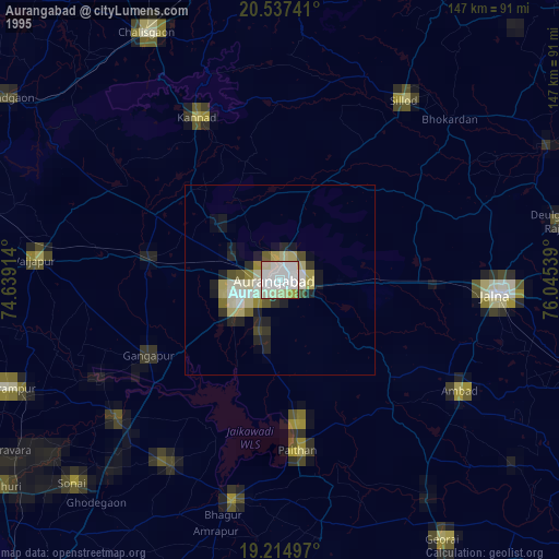
» NASA, Earths city lights 1995
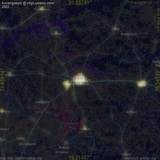
» NASA city lights 2003
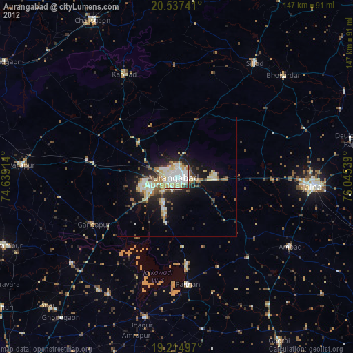
» Earth at Night: Flat Maps 2012, 2016