Galiākot night lights from space
Night Light of Galiākot (Rajasthan) from space (India) Src. Average luminocity for 10x10km area is 1.7123% and for 50x50km: 2.3082%.
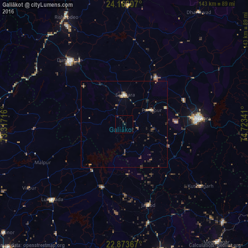
Analysis of Galiākot night lights 2016
Square area 10x10 km:
 0%
0%90-99
0%80-89
0%70-79
0%60-69
0%50-59
0%40-49
1.98%30-39
0.4%20-29
2.38%10-19
0%0-9
95.24%Square area 50x50 km:
0.01%90-99
0.24%80-89
0.22%70-79
0.25%60-69
0.21%50-59
0.48%40-49
0.65%30-39
0.67%20-29
0.94%10-19
0.51%0-9
95.82%Clear (daylight) street map image can be seen on geolist.org.
Map coordinates:
24° 9' 47.1" North, 73° 19' 1.8" East
23° 31' 11.8" North, 74° 1' 13" East
22° 52' 25.2" North, 74° 43' 24.3" East
Some cities around Galiākot sort by population:
• Bānswāra
43.1 km =26.8 mi,  86°
86°
• Dūngarpur
47.5 km =29.5 mi,  319°
319°
• Lūnāvāda
60.4 km =37.5 mi,  223°
223°
• Meghraj
51.7 km =32.1 mi,  267°
267°
• Kushālgarh
56.6 km =35.2 mi,  129°
129°
• Partāpur
17.6 km =10.9 mi,  62°
62°
• Virpur
66.3 km =41.2 mi,  236°
236°
• Mālpur
59.3 km =36.8 mi,  252°
252°
1271771 (p: 6,906)
Sources (retrieved 2019-11-25):
» Earth at Night: Flat Maps 2012, 2016