Hujra Shah Muqim night lights from space
Night Light of Hujra Shah Muqim (Punjab) from space (Pakistan) Src. Average luminocity for 10x10km area is 4.2413% and for 50x50km: 5.0589%.
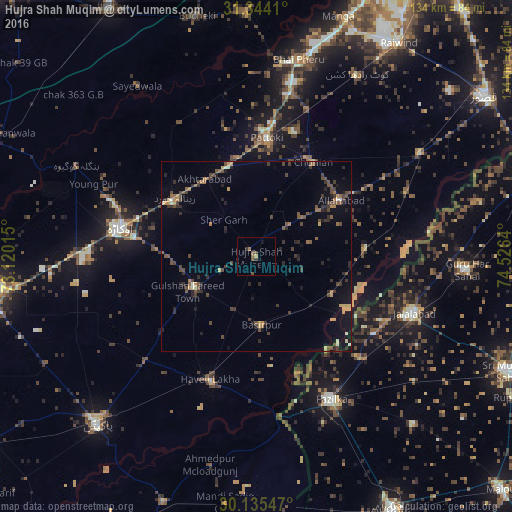
Analysis of Hujra Shah Muqim night lights 2016
Square area 10x10 km:
 0%
0%90-99
0%80-89
0%70-79
0.7%60-69
0.7%50-59
2.1%40-49
1.75%30-39
1.05%20-29
0.7%10-19
1.57%0-9
91.43%Square area 50x50 km:
0.07%90-99
0.29%80-89
0.28%70-79
0.73%60-69
0.6%50-59
0.85%40-49
1.89%30-39
1.21%20-29
1.64%10-19
2.06%0-9
90.38%Clear (daylight) street map image can be seen on geolist.org.
Map coordinates:
31° 20' 38.8" North, 73° 7' 12.5" East
30° 44' 30" North, 73° 49' 23.8" East
30° 8' 7.7" North, 74° 31' 35" East
Some cities around Hujra Shah Muqim sort by population:
• Dipalpur
18.1 km =11.2 mi,  243°
243°
• Pattoki
31.1 km =19.3 mi,  5°
5°
• Haveli Lakha
34.6 km =21.5 mi,  200°
200°
• Chunian
29.1 km =18.1 mi,  30°
30°
• Mustafābād
35.2 km =21.9 mi,  298°
298°
• Basirpur
18.3 km =11.4 mi,  175°
175°
• Renala Khurd
26.3 km =16.3 mi,  305°
305°
• Kanganpur
28.7 km =17.8 mi,  84°
84°
1176800 (p: 61,546)
Sources (retrieved 2019-11-25):
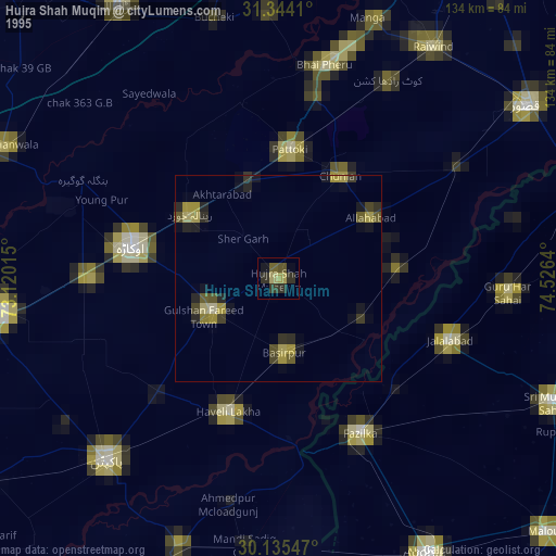
» NASA, Earths city lights 1995
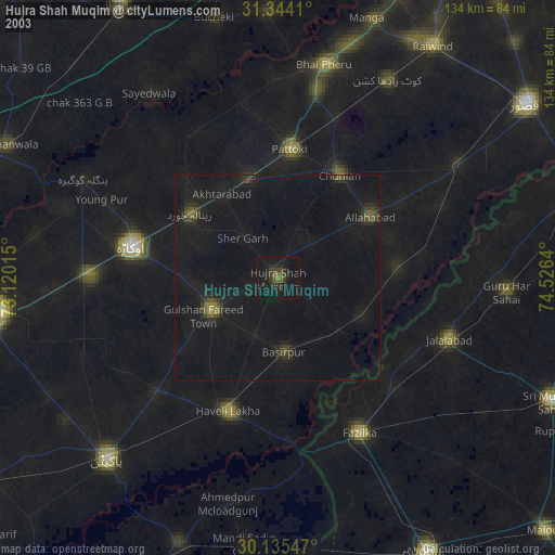
» NASA city lights 2003
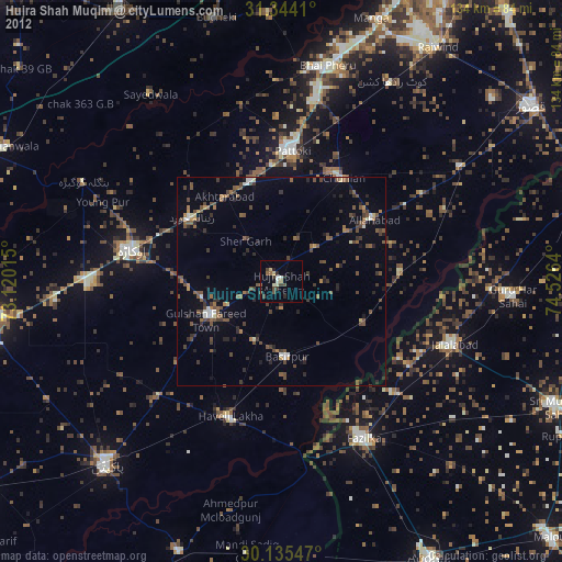
» Earth at Night: Flat Maps 2012, 2016