Dharmapuri night lights from space
Night Light of Dharmapuri (Tamil Nadu) from space (India) Src. Average luminocity for 10x10km area is 38.2831% and for 50x50km: 5.3925%.
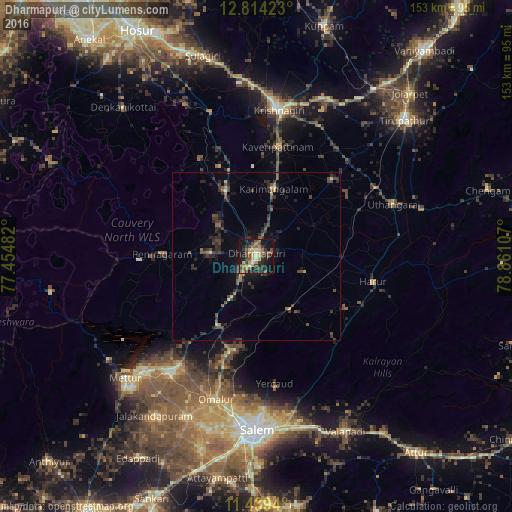
Analysis of Dharmapuri night lights 2016
Square area 10x10 km:
 0.62%
0.62%90-99
3.51%80-89
9.09%70-79
3.72%60-69
6.82%50-59
9.71%40-49
8.88%30-39
9.71%20-29
8.88%10-19
33.88%0-9
5.17%Square area 50x50 km:
0.03%90-99
0.27%80-89
0.56%70-79
0.32%60-69
0.61%50-59
1.01%40-49
1.71%30-39
1.68%20-29
2.58%10-19
3.78%0-9
87.46%Clear (daylight) street map image can be seen on geolist.org.
Map coordinates:
12° 48' 51.2" North, 77° 27' 17.4" East
12° 7' 39.7" North, 78° 9' 28.6" East
11° 26' 21.8" North, 78° 51' 39.9" East
Some cities around Dharmapuri sort by population:
• Pallippatti
33.7 km =20.9 mi,  128°
128°
• Pālakkodu
22.1 km =13.7 mi,  334°
334°
• Pennāgaram
28.6 km =17.8 mi,  271°
271°
• Kāveripatnam
33.4 km =20.8 mi,  11°
11°
• Mallāpuram
18.9 km =11.7 mi,  148°
148°
• Pāppārappatti
14.9 km =9.3 mi,  313°
313°
• Mārāndahalli
33.5 km =20.8 mi, 329°
• Pāpireddippatti
32.7 km =20.3 mi,  135°
135°
1272847 (p: 66,017)
Sources (retrieved 2019-11-25):
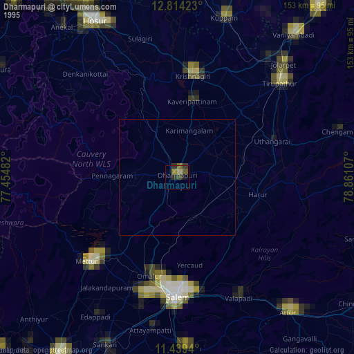
» NASA, Earths city lights 1995
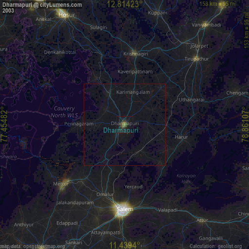
» NASA city lights 2003
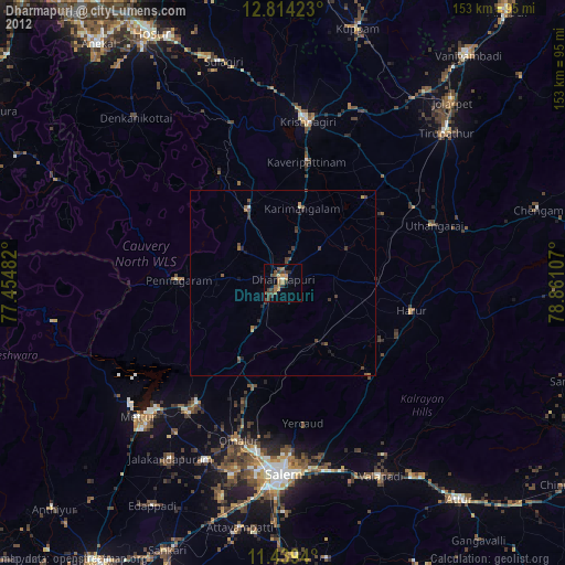
» Earth at Night: Flat Maps 2012, 2016