Chīrāla night lights from space
Night Light of Chīrāla (Andhra Pradesh) from space (India) Src. Average luminocity for 10x10km area is 43.6407% and for 50x50km: 11.4631%.
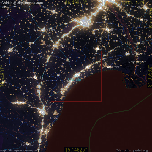
Analysis of Chīrāla night lights 2016
Square area 10x10 km:
 3.25%
3.25%90-99
15.15%80-89
3.03%70-79
1.52%60-69
8.66%50-59
7.14%40-49
3.03%30-39
6.49%20-29
19.26%10-19
30.52%0-9
1.95%Square area 50x50 km:
0.3%90-99
1.83%80-89
0.74%70-79
1%60-69
1.97%50-59
2.12%40-49
1.84%30-39
1.97%20-29
3.21%10-19
13.4%0-9
71.61%Clear (daylight) street map image can be seen on geolist.org.
Map coordinates:
16° 29' 57" North, 79° 38' 56.7" East
15° 49' 25.9" North, 80° 21' 7.9" East
15° 8' 46.5" North, 81° 3' 19.2" East
Some cities around Chīrāla sort by population:
• Ongole
48.5 km =30.1 mi,  222°
222°
• Chilakalūrupet
35.6 km =22.1 mi,  326°
326°
• Bāpatla
15.2 km =9.4 mi,  54°
54°
• Ponnūru
34.3 km =21.3 mi,  38°
38°
• Ponnur
34.7 km =21.6 mi, 37°
• Vetapālem
6.5 km =4 mi,  228°
228°
• Addanki
40.6 km =25.2 mi,  267°
267°
• Pavuluru
20.3 km =12.6 mi,  279°
279°
1274106 (p: 87,001)
Sources (retrieved 2019-11-25):
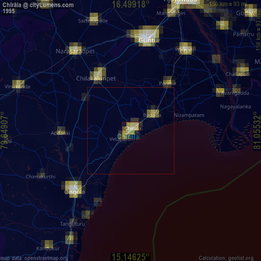
» NASA, Earths city lights 1995
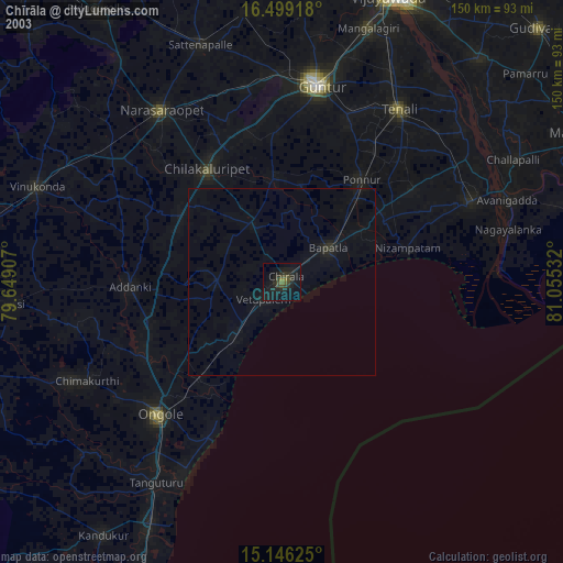
» NASA city lights 2003
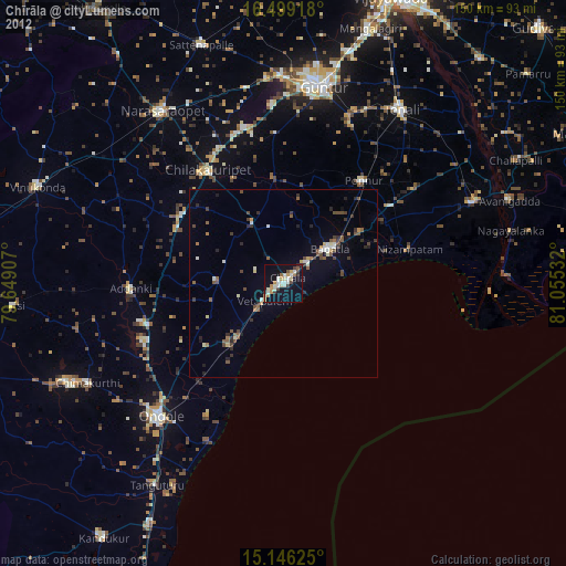
» Earth at Night: Flat Maps 2012, 2016