Bāpatla night lights from space
Night Light of Bāpatla (Andhra Pradesh) from space (India) Src. Average luminocity for 10x10km area is 35.0368% and for 50x50km: 11.9791%.
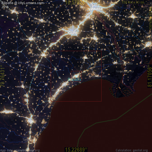
Analysis of Bāpatla night lights 2016
Square area 10x10 km:
 1.52%
1.52%90-99
8.44%80-89
2.81%70-79
5.41%60-69
5.19%50-59
6.28%40-49
4.98%30-39
3.68%20-29
7.36%10-19
45.45%0-9
8.87%Square area 50x50 km:
0.35%90-99
1.85%80-89
0.76%70-79
1.12%60-69
1.96%50-59
2.19%40-49
2.2%30-39
2.27%20-29
3.29%10-19
13.01%0-9
70.99%Clear (daylight) street map image can be seen on geolist.org.
Map coordinates:
16° 34' 45.4" North, 79° 45' 51.5" East
15° 54' 15.2" North, 80° 28' 2.7" East
15° 13' 36.8" North, 81° 10' 14" East
Some cities around Bāpatla sort by population:
• Chilakalūrupet
38.2 km =23.7 mi,  302°
302°
• Chīrāla
15.2 km =9.4 mi,  234°
234°
• Ponnūru
20.1 km =12.5 mi,  26°
26°
• Ponnur
20.5 km =12.7 mi, 25°
• Repalle
40.7 km =25.3 mi,  71°
71°
• Vetapālem
21.7 km =13.5 mi, 232°
• Bhattiprolu
40.1 km =24.9 mi,  56°
56°
• Pavuluru
32.9 km =20.4 mi,  260°
260°
1277183 (p: 70,117)
Sources (retrieved 2019-11-25):
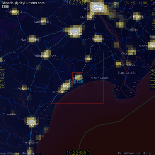
» NASA, Earths city lights 1995
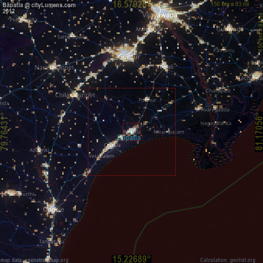
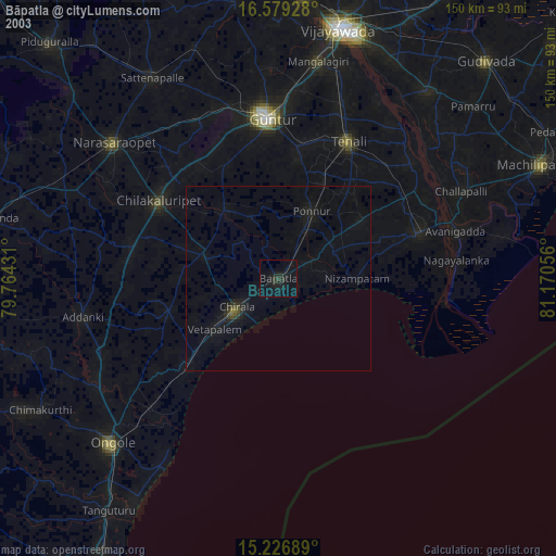
» NASA city lights 2003
» Earth at Night: Flat Maps 2012, 2016