Chandrakona night lights from space
Night Light of Chandrakona (West Bengal) from space (India) Src. Average luminocity for 10x10km area is 13.379% and for 50x50km: 10.9946%.
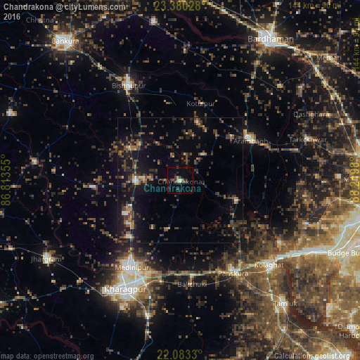

Analysis of Chandrakona night lights 2016
Square area 10x10 km:
 0.2%
0.2%90-99
1.39%80-89
0%70-79
2.58%60-69
0.6%50-59
1.59%40-49
5.16%30-39
3.57%20-29
5.56%10-19
3.77%0-9
75.6%Square area 50x50 km:
0.26%90-99
0.74%80-89
0.58%70-79
0.91%60-69
1.02%50-59
1.9%40-49
3.7%30-39
3.28%20-29
5.16%10-19
10.2%0-9
72.24%Clear (daylight) street map image can be seen on geolist.org.
Map coordinates:
23° 22' 49" North, 86° 48' 48.8" East
22° 43' 60" North, 87° 31' 0" East
22° 4' 59.9" North, 88° 13' 11.3" East
Some cities around Chandrakona sort by population:
• Medinīpur
40 km =24.9 mi,  209°
209°
• Bishnupur
42.9 km =26.7 mi,  331°
331°
• Arāmbāgh
32 km =19.9 mi,  58°
58°
• Ghātāl
23.6 km =14.7 mi,  109°
109°
• Āmlāgora
22.4 km =13.9 mi,  304°
304°
• Rāmjībanpur
14.2 km =8.8 mi,  41°
41°
• Bāli Chak
41.1 km =25.5 mi,  174°
174°
• Kharar
16.6 km =10.3 mi,  94°
94°
1274699 (p: 21,855)
Sources (retrieved 2019-11-25):
» Earth at Night: Flat Maps 2012, 2016