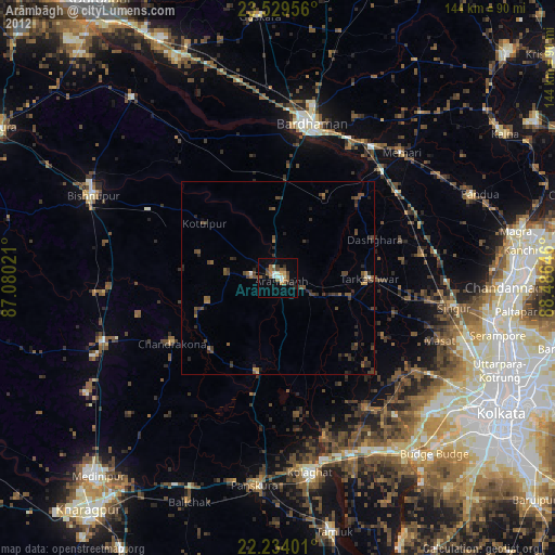
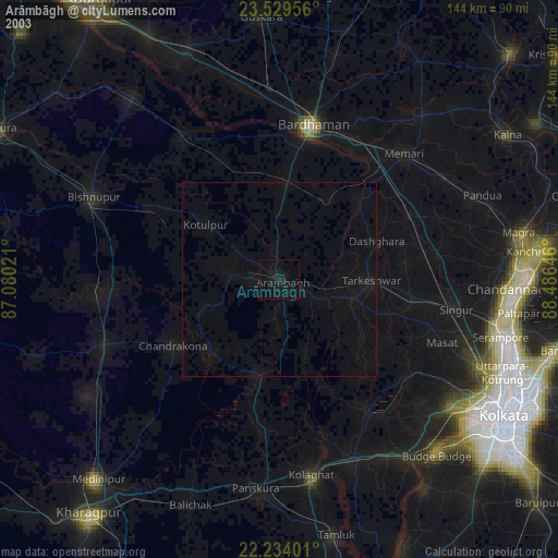
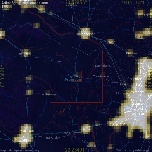
Arāmbāgh night lights from space
Night Light of Arāmbāgh (West Bengal) from space (India) Src. Average luminocity for 10x10km area is 26.0278% and for 50x50km: 8.6651%.
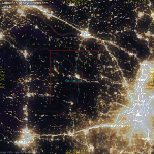
Analysis of Arāmbāgh night lights 2016
Square area 10x10 km:
 1.59%
1.59%90-99
4.37%80-89
3.37%70-79
4.56%60-69
2.38%50-59
3.17%40-49
3.97%30-39
3.37%20-29
5.36%10-19
35.71%0-9
32.14%Square area 50x50 km:
0.12%90-99
0.36%80-89
0.61%70-79
0.59%60-69
0.55%50-59
1.63%40-49
2.99%30-39
2.89%20-29
4.4%10-19
5.62%0-9
80.23%Clear (daylight) street map image can be seen on geolist.org.
Map coordinates:
23° 31' 46.4" North, 87° 4' 48.8" East
22° 52' 60" North, 87° 46' 60" East
22° 14' 2.4" North, 88° 29' 11.3" East
Some cities around Arāmbāgh sort by population:
• Ghātāl
25.1 km =15.6 mi,  191°
191°
• Tarakeswar
23.6 km =14.7 mi,  89°
89°
• Chandrakona
32 km =19.9 mi,  238°
238°
• Srirāmpur
25.3 km =15.7 mi,  73°
73°
• Rāmjībanpur
18.9 km =11.7 mi,  251°
251°
• Āmta
40.7 km =25.3 mi,  145°
145°
• Kharar
20.9 km =13 mi,  211°
211°
• Bāgnān
36.8 km =22.9 mi,  81°
81°
1278466 (p: 60,639)
Sources (retrieved 2019-11-25):
» NASA, Earths city lights 1995
» NASA city lights 2003
» Earth at Night: Flat Maps 2012, 2016