Bishnupur night lights from space
Night Light of Bishnupur (West Bengal) from space (India) Src. Average luminocity for 10x10km area is 33.0436% and for 50x50km: 7.8701%.
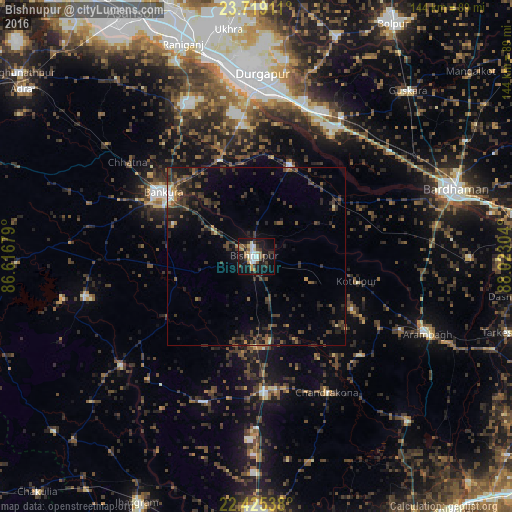
Analysis of Bishnupur night lights 2016
Square area 10x10 km:
 3.6%
3.6%90-99
7.77%80-89
3.03%70-79
2.84%60-69
4.73%50-59
4.55%40-49
3.79%30-39
7.39%20-29
6.25%10-19
36.55%0-9
19.51%Square area 50x50 km:
0.3%90-99
0.6%80-89
0.39%70-79
0.48%60-69
0.78%50-59
1.4%40-49
2.2%30-39
3.01%20-29
4.25%10-19
5.39%0-9
81.19%Clear (daylight) street map image can be seen on geolist.org.
Map coordinates:
23° 43' 8.8" North, 86° 37' 0.4" East
23° 4' 25.7" North, 87° 19' 11.7" East
22° 25' 31.4" North, 88° 1' 22.9" East
Some cities around Bishnupur sort by population:
• Bānkura
30.9 km =19.2 mi,  304°
304°
• Sonāmukhi
27.4 km =17 mi,  20°
20°
• Chandrakona
42.9 km =26.7 mi,  151°
151°
• Āmlāgora
25.4 km =15.8 mi,  176°
176°
• Rāmjībanpur
40.3 km =25 mi,  132°
132°
• Barjora
39.4 km =24.5 mi,  355°
355°
• Pātrasāer
25.8 km =16 mi,  57°
57°
• Beliātor
29.2 km =18.1 mi,  339°
339°
1275462 (p: 64,041)
Sources (retrieved 2019-11-25):
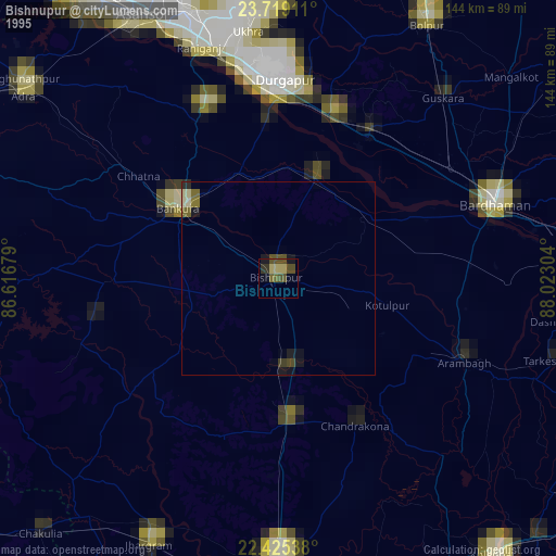
» NASA, Earths city lights 1995
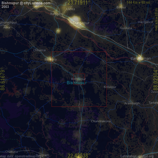
» NASA city lights 2003
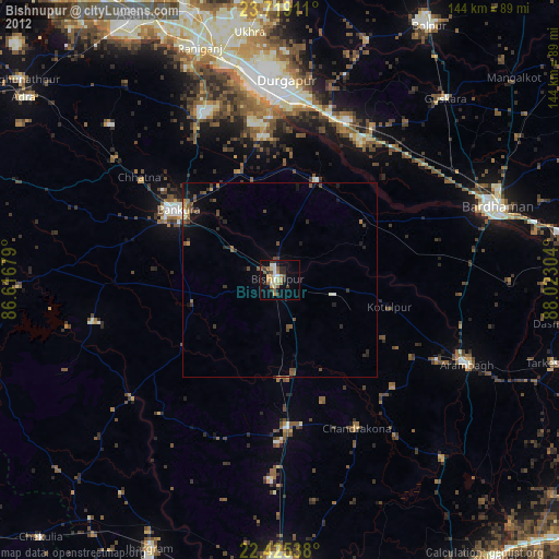
» Earth at Night: Flat Maps 2012, 2016