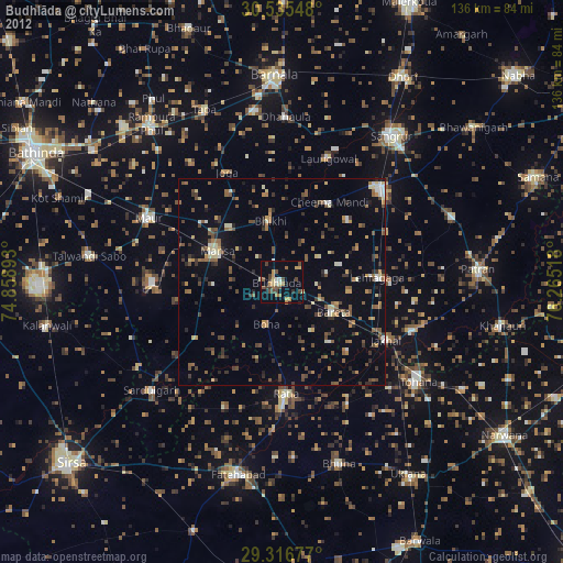
Budhlāda night lights from space
Night Light of Budhlāda (Punjab) from space (India) Src. Average luminocity for 10x10km area is 18.178% and for 50x50km: 8.2684%.
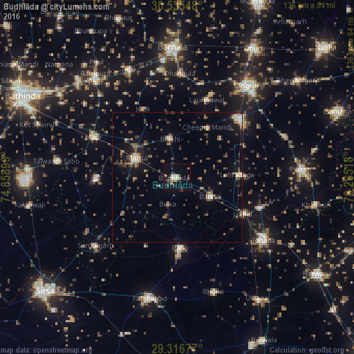
Analysis of Budhlāda night lights 2016
Square area 10x10 km:
 0.57%
0.57%90-99
3.41%80-89
2.08%70-79
1.52%60-69
2.65%50-59
2.65%40-49
0.95%30-39
7.39%20-29
3.22%10-19
6.06%0-9
69.51%Square area 50x50 km:
0.28%90-99
0.66%80-89
0.74%70-79
0.61%60-69
1.17%50-59
1.51%40-49
1.96%30-39
2.47%20-29
2.19%10-19
4.62%0-9
83.79%Clear (daylight) street map image can be seen on geolist.org.
Map coordinates:
30° 32' 7.7" North, 74° 51' 32.1" East
29° 55' 40.8" North, 75° 33' 43.4" East
29° 19' 0.4" North, 76° 15' 54.6" East
Some cities around Budhlāda sort by population:
• Mānsa
16.8 km =10.4 mi,  293°
293°
• Sunām
32 km =19.9 mi,  45°
45°
• Maur
34.7 km =21.6 mi,  299°
299°
• Ratia
26.5 km =16.5 mi,  176°
176°
• Laungowāl
31.7 km =19.7 mi,  21°
21°
• Bhīkhi
14.8 km =9.2 mi,  349°
349°
• Jākhal
29.2 km =18.1 mi,  120°
120°
• Akālgarh
33.9 km =21.1 mi,  110°
110°
1275147 (p: 25,431)
Sources (retrieved 2019-11-25):
» Earth at Night: Flat Maps 2012, 2016