Bilāspur night lights from space
Night Light of Bilāspur (Chhattisgarh) from space (India) Src. Average luminocity for 10x10km area is 96.5536% and for 50x50km: 47.7645%.
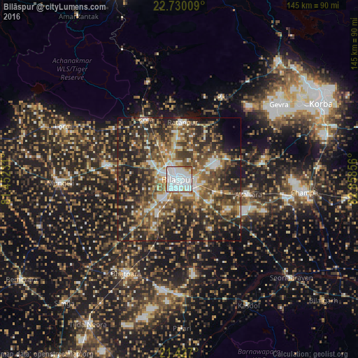
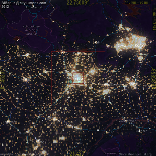
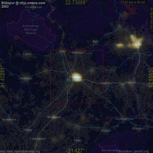
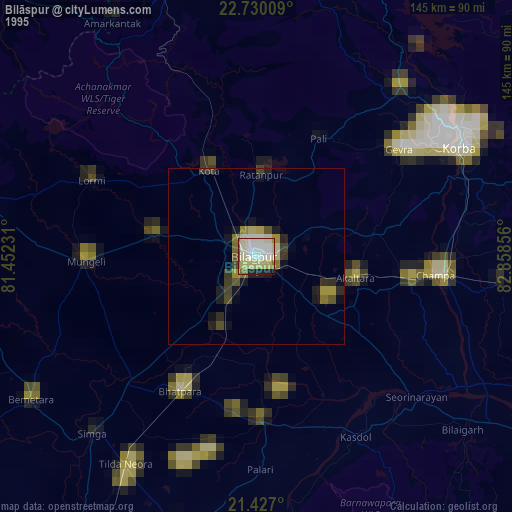
Analysis of Bilāspur night lights 2016
Square area 10x10 km:
 58.93%
90-99
29.96%80-89
4.76%70-79
2.98%60-69
1.98%50-59
1.39%40-49
0%30-39
0%20-29
0%10-19
0%0-9
0%Square area 50x50 km:
6.34%90-99
7.2%80-89
5.11%70-79
6.22%60-69
7.54%50-59
10.65%40-49
11.02%30-39
10.49%20-29
16.5%10-19
14.35%0-9
4.58%Clear (daylight) street map image can be seen on geolist.org.
Map coordinates:
22° 43' 48.3" North, 81° 27' 8.3" East
22° 4' 48.2" North, 82° 9' 19.5" East
21° 25' 37.2" North, 82° 51' 30.8" East
Some cities around Bilāspur sort by population:
• Bhātāpāra
44 km =27.3 mi,  209°
209°
• Jānjgīr
44.2 km =27.5 mi,  100°
100°
• Baloda Bāzār
47.1 km =29.3 mi,  179°
179°
• Ratanpur
23 km =14.3 mi,  3°
3°
• Akaltara
28.6 km =17.8 mi, 102°
• Takhatpur
29.9 km =18.6 mi,  280°
280°
• Kotā
27.5 km =17.1 mi,  330°
330°
• Baloda
34.2 km =21.3 mi,  78°
78°
1275637 (p: 282,705)
Sources (retrieved 2019-11-25):
» NASA, Earths city lights 1995
» NASA city lights 2003
» Earth at Night: Flat Maps 2012, 2016