Batāla night lights from space
Night Light of Batāla (Punjab) from space (India) Src. Average luminocity for 10x10km area is 52.1081% and for 50x50km: 20.6266%.
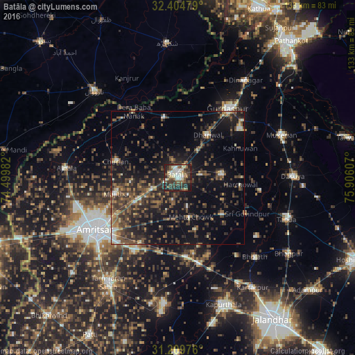
Analysis of Batāla night lights 2016
Square area 10x10 km:
 5.31%
5.31%90-99
15.57%80-89
5.86%70-79
1.83%60-69
5.68%50-59
9.16%40-49
13.19%30-39
13.37%20-29
22.34%10-19
7.69%0-9
0%Square area 50x50 km:
0.8%90-99
2.37%80-89
1.43%70-79
1.35%60-69
2.53%50-59
4.58%40-49
6.65%30-39
6.34%20-29
8.34%10-19
16.1%0-9
49.51%Clear (daylight) street map image can be seen on geolist.org.
Map coordinates:
32° 24' 17.2" North, 74° 29' 59.4" East
31° 48' 33.2" North, 75° 12' 10.6" East
31° 12' 35.1" North, 75° 54' 21.9" East
Some cities around Batāla sort by population:
• Qādiān
16.5 km =10.3 mi,  85°
85°
• Dhāriwāl
19.9 km =12.4 mi,  34°
34°
• Fatehgarh Chūriān
24.1 km =15 mi,  284°
284°
• Majītha
23.8 km =14.8 mi,  255°
255°
• Kalanaur
23.1 km =14.4 mi,  347°
347°
• Jandiāla Gurū
32.1 km =19.9 mi,  211°
211°
• Derā Nānak
30.3 km =18.8 mi,  326°
326°
• Rām Dās
32.9 km =20.4 mi,  302°
302°
1276720 (p: 145,468)
Sources (retrieved 2019-11-25):
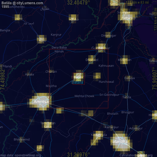
» NASA, Earths city lights 1995
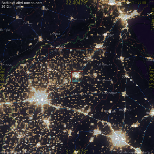
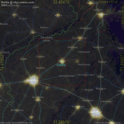
» NASA city lights 2003
» Earth at Night: Flat Maps 2012, 2016