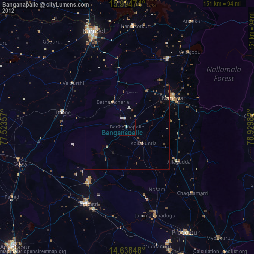
Banganapalle night lights from space
Night Light of Banganapalle (Andhra Pradesh) from space (India) Src. Average luminocity for 10x10km area is 19.6384% and for 50x50km: 4.7547%.
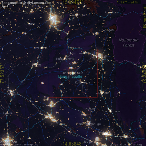
Analysis of Banganapalle night lights 2016
Square area 10x10 km:
 0.41%
0.41%90-99
3.72%80-89
1.65%70-79
1.24%60-69
4.75%50-59
3.51%40-49
2.69%30-39
4.13%20-29
2.69%10-19
17.77%0-9
57.44%Square area 50x50 km:
0.14%90-99
0.66%80-89
0.33%70-79
0.17%60-69
0.78%50-59
0.84%40-49
1.13%30-39
1.11%20-29
1.42%10-19
2.69%0-9
90.73%Clear (daylight) street map image can be seen on geolist.org.
Map coordinates:
15° 59' 41.1" North, 77° 31' 24.9" East
15° 19' 3.8" North, 78° 13' 36.1" East
14° 38' 18.5" North, 78° 55' 47.4" East
Some cities around Banganapalle sort by population:
• Kurnool
60.4 km =37.5 mi,  340°
340°
• Nandyāl
32.8 km =20.4 mi,  57°
57°
• Tādpatri
51.1 km =31.8 mi,  207°
207°
• Nandikotkūr
60.1 km =37.3 mi,  3°
3°
• Jammalamadugu
55 km =34.2 mi,  162°
162°
• Dhone
39 km =24.2 mi,  282°
282°
• Betamcherla
17.1 km =10.6 mi,  330°
330°
• Rāmāpuram
38.7 km =24 mi,  265°
265°
1277330 (p: 25,325)
Sources (retrieved 2019-11-25):
» Earth at Night: Flat Maps 2012, 2016