Konnagar night lights from space
Night Light of Konnagar (West Bengal) from space (India) Src. Average luminocity for 10x10km area is 98.1687% and for 50x50km: 75.9674%.
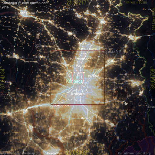
Analysis of Konnagar night lights 2016
Square area 10x10 km:
 55.36%
90-99
43.06%80-89
1.59%70-79
0%60-69
0%50-59
0%40-49
0%30-39
0%20-29
0%10-19
0%0-9
0%Square area 50x50 km:
22.6%90-99
25.88%80-89
10.13%70-79
6.52%60-69
7.7%50-59
7.87%40-49
6.57%30-39
4.29%20-29
4.38%10-19
4.03%0-9
0.02%Clear (daylight) street map image can be seen on geolist.org.
Map coordinates:
23° 21' 7.8" North, 87° 38' 28.8" East
22° 42' 18.3" North, 88° 20' 40.1" East
22° 3' 17.7" North, 89° 2' 51.3" East
Some cities around Konnagar sort by population:
• Pānihāti
3.4 km =2.1 mi,  117°
117°
• Kāmārhāti
4.9 km =3 mi,  140°
140°
• Bāli
6.3 km =3.9 mi,  183°
183°
• Shrīrāmpur
5.3 km =3.3 mi,  357°
357°
• Khardah
3.8 km =2.4 mi,  66°
66°
• Titāgarh
5.1 km =3.2 mi,  35°
35°
• Rishra
2.1 km =1.3 mi,  3°
3°
• Sodpur
4.8 km =3 mi,  91°
91°
1266179 (p: 76,082)
Sources (retrieved 2019-11-25):
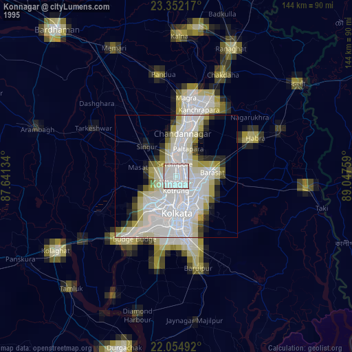
» NASA, Earths city lights 1995
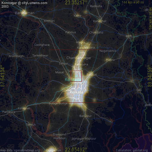
» NASA city lights 2003
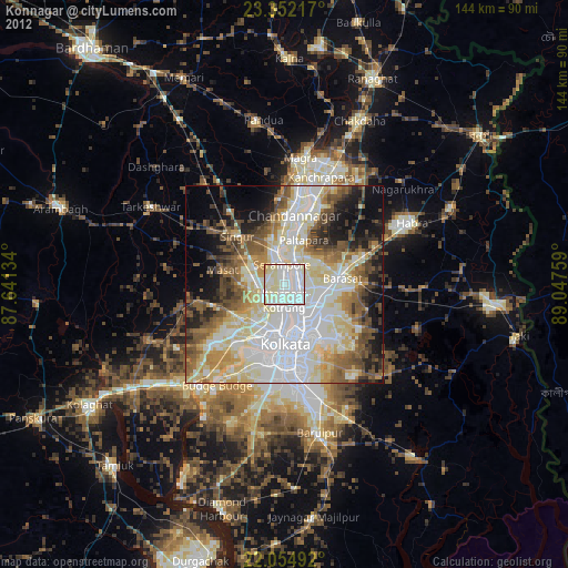
» Earth at Night: Flat Maps 2012, 2016