Kāmārhāti night lights from space
Night Light of Kāmārhāti (West Bengal) from space (India) Src. Average luminocity for 10x10km area is 99.4802% and for 50x50km: 78.8387%.
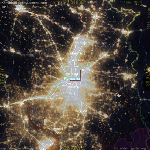
Analysis of Kāmārhāti night lights 2016
Square area 10x10 km:
 77.78%
90-99
22.22%80-89
0%70-79
0%60-69
0%50-59
0%40-49
0%30-39
0%20-29
0%10-19
0%0-9
0%Square area 50x50 km:
24.4%90-99
26.75%80-89
11.02%70-79
6.61%60-69
7.44%50-59
8.02%40-49
6.88%30-39
4.42%20-29
3.27%10-19
1.18%0-9
0%Clear (daylight) street map image can be seen on geolist.org.
Map coordinates:
23° 19' 6.1" North, 87° 40' 17.8" East
22° 40' 16" North, 88° 22' 29" East
22° 1' 14.8" North, 89° 4' 40.3" East
Some cities around Kāmārhāti sort by population:
• Pānihāti
2.2 km =1.4 mi,  358°
358°
• Bāli
4.3 km =2.7 mi,  233°
233°
• Baranagar
3.3 km =2.1 mi,  175°
175°
• Khardah
5.3 km =3.3 mi,  3°
3°
• Konnagar
4.9 km =3 mi,  320°
320°
• Chakapara
5.1 km =3.2 mi,  211°
211°
• Garui
4.9 km =3 mi,  148°
148°
• Sodpur
4.1 km =2.5 mi,  25°
25°
1268257 (p: 332,965)
Sources (retrieved 2019-11-25):
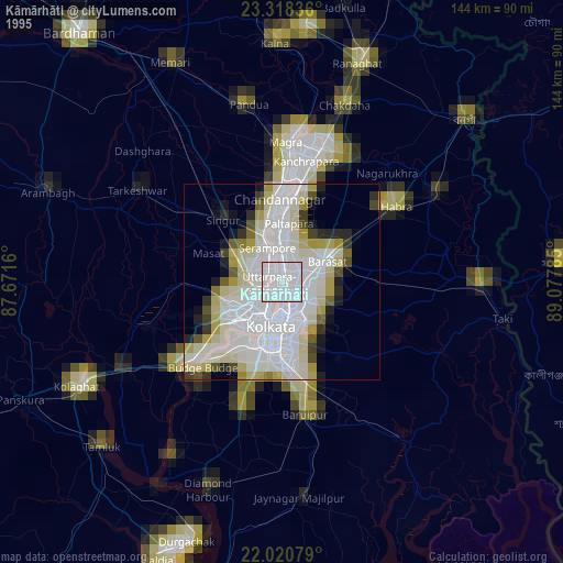
» NASA, Earths city lights 1995
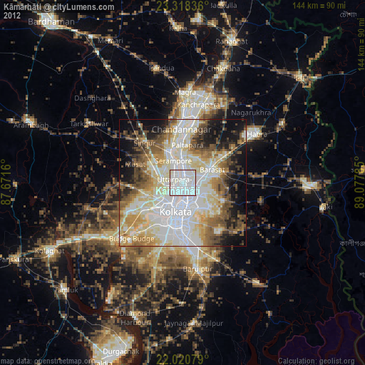
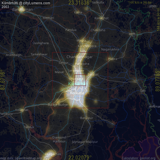
» NASA city lights 2003
» Earth at Night: Flat Maps 2012, 2016