Bada Barabīl night lights from space
Night Light of Bada Barabīl (Odisha) from space (India) Src. Average luminocity for 10x10km area is 71.3333% and for 50x50km: 22.6772%.
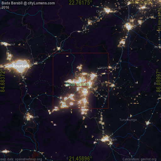
Analysis of Bada Barabīl night lights 2016
Square area 10x10 km:
 12.7%
12.7%90-99
20.24%80-89
7.94%70-79
5.75%60-69
18.06%50-59
16.27%40-49
11.51%30-39
5.16%20-29
2.18%10-19
0.2%0-9
0%Square area 50x50 km:
2.83%90-99
4.46%80-89
1.88%70-79
2.16%60-69
2.55%50-59
5.05%40-49
5.65%30-39
5.31%20-29
6.21%10-19
9.15%0-9
54.74%Clear (daylight) street map image can be seen on geolist.org.
Map coordinates:
22° 45' 42.3" North, 84° 41' 1.4" East
22° 6' 42.7" North, 85° 23' 12.6" East
21° 27' 32.3" North, 86° 5' 23.9" East
Some cities around Bada Barabīl sort by population:
• Barbil
1.5 km =0.9 mi,  221°
221°
• Noāmundi
13.3 km =8.3 mi,  65°
65°
• Manoharpur
35.4 km =22 mi,  325°
325°
• Bolānīkhodān
5.2 km =3.2 mi,  271°
271°
• Gua
11.3 km =7 mi,  0°
0°
• Kiri Buru
4.9 km =3 mi,  230°
230°
• Chāmpua
29 km =18 mi,  99°
99°
• Jagannāthpur
28.7 km =17.8 mi,  64°
64°
1278026 (p: 56,870)
Sources (retrieved 2019-11-25):
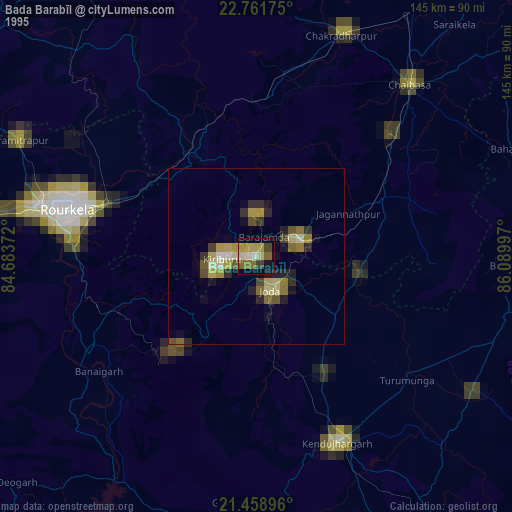
» NASA, Earths city lights 1995
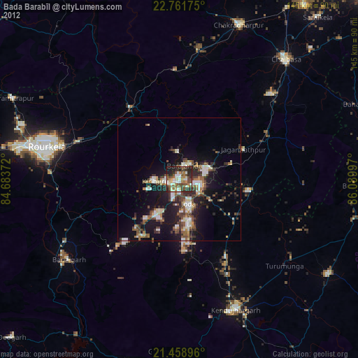
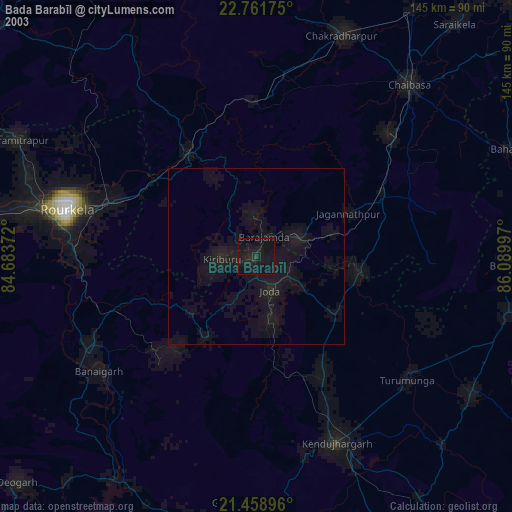
» NASA city lights 2003
» Earth at Night: Flat Maps 2012, 2016