Amarwāra night lights from space
Night Light of Amarwāra (Madhya Pradesh) from space (India) Src. Average luminocity for 10x10km area is 4.9659% and for 50x50km: 2.6541%.
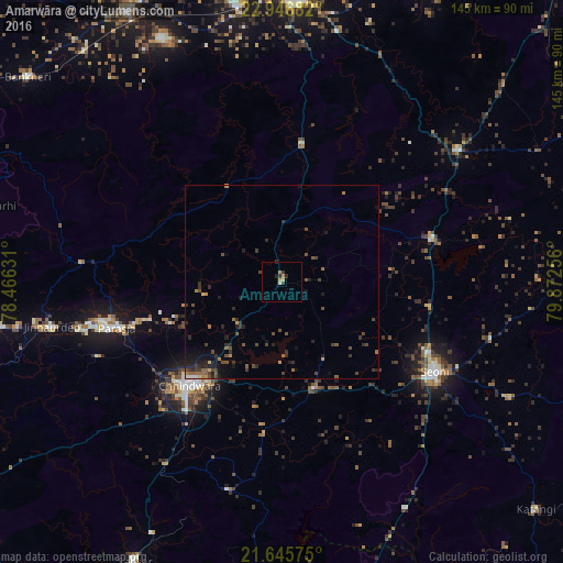
Analysis of Amarwāra night lights 2016
Square area 10x10 km:
 0%
0%90-99
0%80-89
1.52%70-79
1.7%60-69
0.57%50-59
0%40-49
0%30-39
2.08%20-29
2.08%10-19
0%0-9
92.05%Square area 50x50 km:
0.06%90-99
0.07%80-89
0.18%70-79
0.29%60-69
0.38%50-59
0.57%40-49
0.89%30-39
0.88%20-29
1.14%10-19
1.52%0-9
94.03%Clear (daylight) street map image can be seen on geolist.org.
Map coordinates:
22° 56' 48.6" North, 78° 27' 58.7" East
22° 17' 52.1" North, 79° 10' 9.9" East
21° 38' 44.7" North, 79° 52' 21.2" East
Some cities around Amarwāra sort by population:
• Chhindwāra
35.7 km =22.2 mi,  221°
221°
• Seoni
45.8 km =28.5 mi,  121°
121°
• Parāsia
43.9 km =27.3 mi,  254°
254°
• Jāmai
60.5 km =37.6 mi,  259°
259°
• Lakhnādon
55.7 km =34.6 mi,  52°
52°
• Barghāt
65.2 km =40.5 mi, 117°
• Harrai
35.6 km =22.1 mi,  8°
8°
• Chichli
69.2 km =43 mi,  329°
329°
1278889 (p: 13,258)
Sources (retrieved 2019-11-25):
» Earth at Night: Flat Maps 2012, 2016