Madanpur night lights from space
Night Light of Madanpur (West Bengal) from space (India) Src. Average luminocity for 10x10km area is 73.9107% and for 50x50km: 43.9987%.
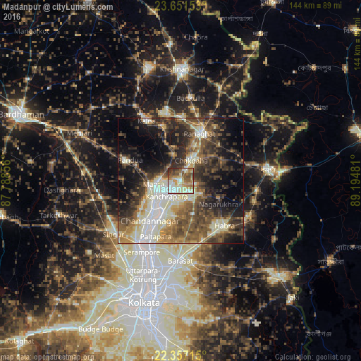
Analysis of Madanpur night lights 2016
Square area 10x10 km:
 10.91%
90-99
25.4%80-89
9.33%70-79
10.91%60-69
14.88%50-59
12.9%40-49
8.73%30-39
5.56%20-29
1.39%10-19
0%0-9
0%Square area 50x50 km:
4.75%90-99
11.6%80-89
4.75%70-79
4.51%60-69
5.92%50-59
8.11%40-49
9.85%30-39
8.7%20-29
10.57%10-19
13.59%0-9
17.64%Clear (daylight) street map image can be seen on geolist.org.
Map coordinates:
23° 39' 5.5" North, 87° 47' 18.8" East
23° 0' 21.2" North, 88° 29' 30" East
22° 21' 25.7" North, 89° 11' 41.3" East
Some cities around Madanpur sort by population:
• Naihāti
14.7 km =9.1 mi,  212°
212°
• Hugli
14.5 km =9 mi,  221°
221°
• Kānchrāpāra
8.2 km =5.1 mi,  231°
231°
• Hālīsahar
11.1 km =6.9 mi, 222°
• Bānsbāria
10.9 km =6.8 mi,  238°
238°
• Kalyani
2.7 km =1.7 mi,  198°
198°
• Haringhāta
9.6 km =6 mi,  118°
118°
• Rāmchandrapur
12.3 km =7.6 mi,  187°
187°
1264614 (p: 12,959)
Sources (retrieved 2019-11-25):
» Earth at Night: Flat Maps 2012, 2016