Qiryat Ata night lights from space
Night Light of Qiryat Ata (Haifa) from space (Israel) Src. Average luminocity for 10x10km area is 89.3199% and for 50x50km: 52.4025%.
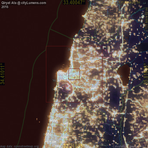
Analysis of Qiryat Ata night lights 2016
Square area 10x10 km:
 29.2%
29.2%90-99
26.75%80-89
19.06%70-79
16.96%60-69
8.04%50-59
0%40-49
0%30-39
0%20-29
0%10-19
0%0-9
0%Square area 50x50 km:
9.87%90-99
9.51%80-89
10.71%70-79
7.96%60-69
9.78%50-59
8.56%40-49
6.45%30-39
6.06%20-29
6.71%10-19
4.27%0-9
20.12%Clear (daylight) street map image can be seen on geolist.org.
Map coordinates:
33° 24' 1.7" North, 34° 24' 36.4" East
32° 48' 41.4" North, 35° 6' 47.6" East
32° 13' 6.9" North, 35° 48' 58.9" East
Some cities around Qiryat Ata sort by population:
• Haifa
11.7 km =7.3 mi,  273°
273°
• Tamra
9.2 km =5.7 mi,  59°
59°
• Nesher
8.2 km =5.1 mi,  232°
232°
• Rekhasim
7.1 km =4.4 mi,  190°
190°
• Kābūl
11.2 km =7 mi, 55°
• Bīr el Maksūr
10.7 km =6.6 mi,  110°
110°
• Basmat Ṭab‘ūn
9 km =5.6 mi,  153°
153°
• Ramat Yishay
13.1 km =8.1 mi,  155°
155°
293845 (p: 48,966)
Sources (retrieved 2019-11-25):
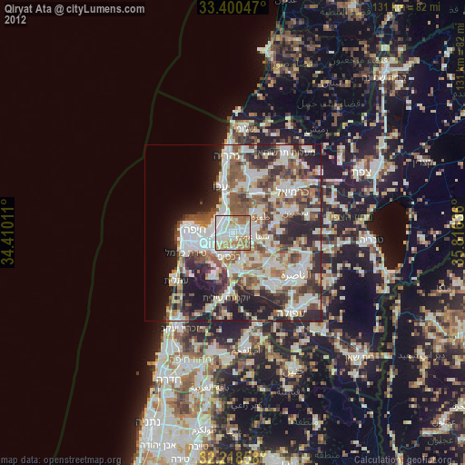
» Earth at Night: Flat Maps 2012, 2016