Terenure night lights from space
Night Light of Terenure (Leinster) from space (Ireland) Src. Average luminocity for 10x10km area is 95.5593% and for 50x50km: 23.7269%.
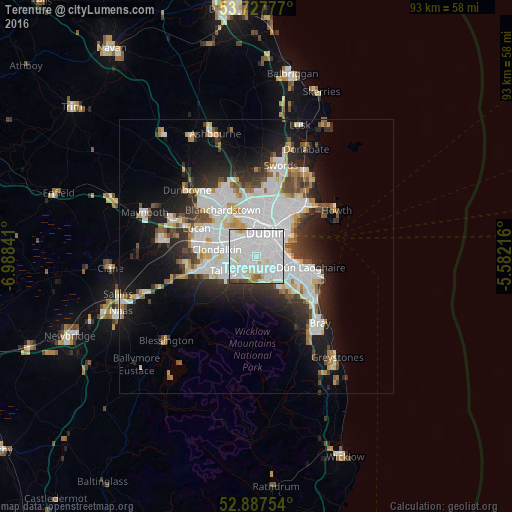
Analysis of Terenure night lights 2016
Square area 10x10 km:
 58.71%
90-99
29.42%80-89
4.42%70-79
1.89%60-69
1.77%50-59
0.63%40-49
2.27%30-39
0.88%20-29
0%10-19
0%0-9
0%Square area 50x50 km:
8.22%90-99
5.41%80-89
1.7%70-79
1.72%60-69
1.72%50-59
1.6%40-49
2.2%30-39
2.68%20-29
5.23%10-19
10.17%0-9
59.36%Clear (daylight) street map image can be seen on geolist.org.
Map coordinates:
53° 43' 40" North, 6° 59' 18.3" West
53° 18' 35" North, 6° 17' 7" West
52° 53' 15.1" North, 5° 34' 55.8" West
Some cities around Terenure sort by population:
• Dublin
3.5 km =2.2 mi,  42°
42°
• Dundrum
2.8 km =1.7 mi,  138°
138°
• Crumlin
2.3 km =1.4 mi,  304°
304°
• Rathmines
1.9 km =1.2 mi,  51°
51°
• Ballyboden
3.8 km =2.4 mi,  212°
212°
• Rathgar
0.9 km =0.6 mi, 51°
• Templeogue
2.2 km =1.4 mi,  224°
224°
• Greenhills
3 km =1.9 mi,  336°
336°
2961235 (p: 7,674)
Sources (retrieved 2019-11-25):
» Earth at Night: Flat Maps 2012, 2016