Crumlin night lights from space
Night Light of Crumlin (Leinster) from space (Ireland) Src. Average luminocity for 10x10km area is 96.9558% and for 50x50km: 24.3453%.
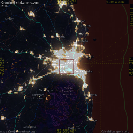
Analysis of Crumlin night lights 2016
Square area 10x10 km:
 54.67%
90-99
34.09%80-89
6.19%70-79
3.54%60-69
1.01%50-59
0.51%40-49
0%30-39
0%20-29
0%10-19
0%0-9
0%Square area 50x50 km:
8.28%90-99
5.53%80-89
1.78%70-79
1.83%60-69
1.76%50-59
1.74%40-49
2.29%30-39
2.72%20-29
5.25%10-19
10.65%0-9
58.16%Clear (daylight) street map image can be seen on geolist.org.
Map coordinates:
53° 44' 22.1" North, 7° 1' 3.1" West
53° 19' 17.5" North, 6° 18' 51.8" West
52° 53' 58.1" North, 5° 36' 40.6" West
Some cities around Crumlin sort by population:
• Dublin
4.5 km =2.8 mi,  73°
73°
• Rathmines
3.4 km =2.1 mi,  92°
92°
• Ballyfermot
3.6 km =2.2 mi,  311°
311°
• Rathgar
2.7 km =1.7 mi,  106°
106°
• Terenure
2.3 km =1.4 mi,  124°
124°
• Templeogue
2.9 km =1.8 mi,  172°
172°
• Greenhills
1.6 km =1 mi,  27°
27°
• Chapelizod
3.5 km =2.2 mi,  327°
327°
2964963 (p: 11,294)
Sources (retrieved 2019-11-25):
» Earth at Night: Flat Maps 2012, 2016