Portmarnock night lights from space
Night Light of Portmarnock (Leinster) from space (Ireland) Src. Average luminocity for 10x10km area is 45.7698% and for 50x50km: 21.6144%.
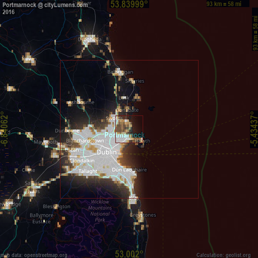
Analysis of Portmarnock night lights 2016
Square area 10x10 km:
 10.71%
90-99
8.6%80-89
4.23%70-79
5.82%60-69
7.94%50-59
6.48%40-49
9.13%30-39
4.1%20-29
7.67%10-19
14.02%0-9
21.3%Square area 50x50 km:
8.04%90-99
4.97%80-89
1.55%70-79
1.51%60-69
1.46%50-59
1.27%40-49
1.93%30-39
2.47%20-29
4.89%10-19
7.54%0-9
64.37%Clear (daylight) street map image can be seen on geolist.org.
Map coordinates:
53° 50' 24" North, 6° 50' 26.2" West
53° 25' 23" North, 6° 8' 15" West
53° 0' 7.2" North, 5° 26' 3.7" West
Some cities around Portmarnock sort by population:
• Swords
6.7 km =4.2 mi,  307°
307°
• Malahide
3.3 km =2.1 mi,  340°
340°
• Donaghmede
3.2 km =2 mi,  210°
210°
• Baldoyle
2.7 km =1.7 mi,  163°
163°
• Raheny
4.9 km =3 mi,  215°
215°
• Kinsealy-Drinan
4.9 km =3 mi,  298°
298°
• Darndale
4.3 km =2.7 mi,  232°
232°
• Artane
6.4 km =4 mi, 231°
2962019 (p: 9,285)
Sources (retrieved 2019-11-25):
» Earth at Night: Flat Maps 2012, 2016