Raheny night lights from space
Night Light of Raheny (Leinster) from space (Ireland) Src. Average luminocity for 10x10km area is 69.7011% and for 50x50km: 22.6029%.
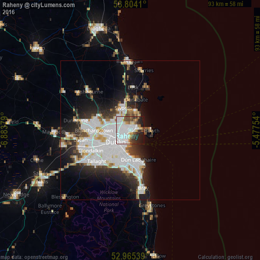
Analysis of Raheny night lights 2016
Square area 10x10 km:
 36.64%
90-99
13.49%80-89
2.65%70-79
4.23%60-69
5.03%50-59
4.37%40-49
6.08%30-39
6.35%20-29
9.79%10-19
10.85%0-9
0.53%Square area 50x50 km:
8.13%90-99
5.22%80-89
1.63%70-79
1.64%60-69
1.58%50-59
1.42%40-49
1.98%30-39
2.55%20-29
5.08%10-19
8.85%0-9
61.91%Clear (daylight) street map image can be seen on geolist.org.
Map coordinates:
53° 48' 14.8" North, 6° 53' 1.6" West
53° 23' 12.5" North, 6° 10' 50.4" West
52° 57' 55.4" North, 5° 28' 39.1" West
Some cities around Raheny sort by population:
• Donaghmede
1.8 km =1.1 mi,  44°
44°
• Beaumont
3.1 km =1.9 mi,  270°
270°
• Baldoyle
3.9 km =2.4 mi,  68°
68°
• Donnycarney
2.4 km =1.5 mi,  232°
232°
• Darndale
1.5 km =0.9 mi,  338°
338°
• Artane
2.2 km =1.4 mi, 270°
• Killester
2.2 km =1.4 mi, 226°
• Dollymount
2.4 km =1.5 mi,  179°
179°
2961960 (p: 7,197)
Sources (retrieved 2019-11-25):
» Earth at Night: Flat Maps 2012, 2016